Weather
New Jersey's Winters, Big Storms Expected To Get Worse, Studies Show
Two reports say that New Jersey's winters and storms will likely get worse and could do more damage in some areas than Superstorm Sandy.

Two recently released reports say that New Jersey's winters and storms will likely get worse and could do more damage than Superstorm Sandy.
One study says that longer, harsher winters may be in store for the portions of North America as the polar vortex continues to weaken and shifts, according to an AccuWeather release.
The polar vortex is a large pocket of frigid air that hovers above the polar regions and is most prominent in the winter months. Researchers at China's Lanzhou University penned the study, which was published in Nature Climate Change last month, according to the release.
Find out what's happening in Toms Riverfor free with the latest updates from Patch.
And a Superstorm Sandy analysis of storm tides from the U.S. Geological Survey concluded northern coastal communities were significantly harder hit than New Jersey's southern towns — and some southern communities, as a result, may be underestimating their future flood risks.
“These communities feel they got the worse of the storm — they didn’t. This could have been worse," Thomas Suro, a hydrologist for the USGS and author of the study, was quoted as saying on NJ Spotlight.
Find out what's happening in Toms Riverfor free with the latest updates from Patch.
In the Lanzhou study about North American winters, researchers found that a loss of sea ice in the Arctic regions because of rising temperatures in the Barents-Kara seas, along with an increase in snow cover over Europe and Asia, has caused the polar vortex to weaken, according to the AccuWeather release.
The pocket of cold air has, in turn, shifted toward Eurasia. This movement could lead to colder and possibly extended winter seasons for portions of North America and Eurasia, according to the study.
"With warming and ridging in the Kara Sea, this typically allows for less ice cover but also is a conducive atmospheric pattern for lower temperatures in the North American mid-latitudes," AccuWeather Meteorologist Edward Vallee said in the release.
A weaker polar vortex allows the stratosphere, or a distant part of the Earth's atmosphere, to warm, while a stronger one prevents that process, according to Vallee.
"The stratospheric vortex typically governs the tropospheric vortex [in the lower part of the Earth's atmosphere] during the winter months and is based on polar heating and cooling," Vallee said.
"As the stratosphere warms in winter, it can reverse the wind direction below it," he said.
This could block high-pressure systems from taking shape in the high latitudes of the Earth, which would increase opportunities for cold in the mid-latitudes. AccuWeather Senior Meteorologist Bob Smerbeck said the southern shift could bring the other end of the polar vortex toward eastern North America, yielding colder winters for the region.
"There are other factors that determine where the vortex sets up," Smerbeck said. "The warm blob over the north Pacific in winter 2013-2014 and the unusually warm waters along the west coast of North America [for the] 2014-2015 winter contributed to a southward dip in the vortex across eastern North America and cold winters in the central and eastern U.S."
At times during the winter, a warm layer of air will develop high up near the stratosphere over eastern Asia and head toward the stratospheric vortex causing it to weaken by being pinched, displaced or even split. This will cause a portion of the stratospheric vortex to extend farther south, according to the release.
NJ Spotlight, meanwhile, said the USGS study is "important" because FEMA recently released flood insurance studies for New Jersey coastal communities, with new estimates of areas at high risk of flooding. "It also occurs at a time when environmentalists have been critical of the state for failing to incorporate sea-level rise into its coastal land-use policies," according to the report.
The study noted that in North Jersey the highest storm tides were 2 feet or more above that one-in-100 flood risk, while in South Jersey, peak storm-tide levels did not reach the one-in-100 flood-level, even as NJ Spotight noted that many communities in these areas experienced severe damage from the storm.
The USGS study suggests that in some southern communities, extreme flooding may occur at peak storm tide levels that are lower than FEMA’s expected flood risks, according to NJ Spotlight.
According to NJ Spotlight:
"The researchers, using tide gauges, sensors, and high-water mark readings from 169 sites, found that peak storm-tide elevations along the northern coast and Raritan Bay generally ranged from about nine feet to 15 feet. Along the central and southern coast from Ocean to Cape May counties, the peak water levels generally ranged from about five feet to 8 feet.
"That led to huge problems, particularly in northern Jersey, where dozens of wastewater treatment plants flooded, dumping raw sewage into rivers and bays, and electric switching and substations were submerged by huge storm surges, leaving more than a million residents without power."
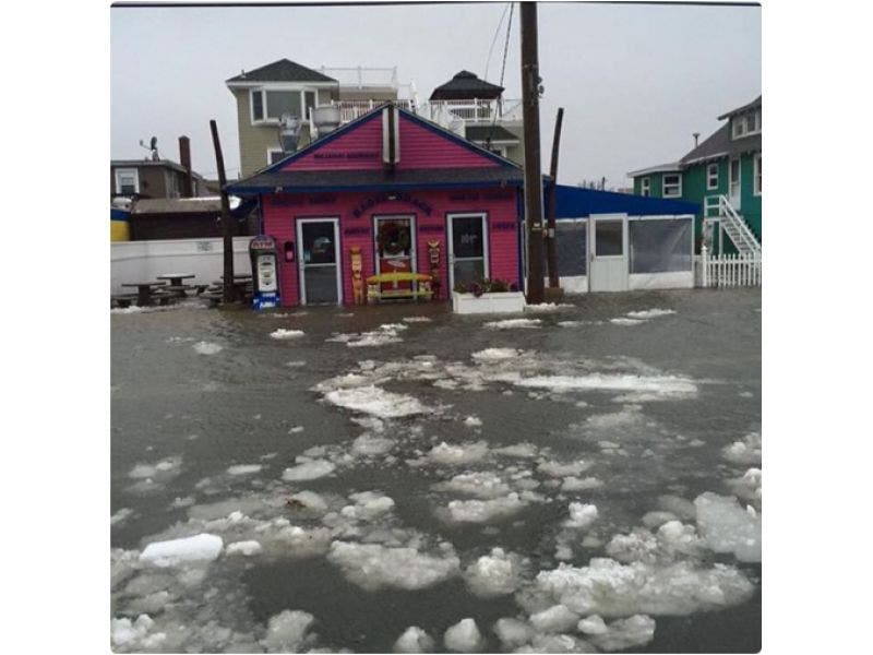
Patch file photo
Get more local news delivered straight to your inbox. Sign up for free Patch newsletters and alerts.


