Weather
Route 35 South, Back Bay Areas Flooded In Toms River After Storm
Monday's heavy rain combined with a southeast wind has been pushing water up onto the roads and into some homes in lowlying areas.

Tide is unbelievably High in NJ Barnegat Bay/Toms River. Streets impassible @AMHQ @jenconnic @News12NJ @joecioffi @NickGregoryFox5 pic.twitter.com/bJJW4CBrxA
— Hurricane Force (@HurricaneForce1) April 16, 2018
TOMS RIVER, NJ — Heavy rain, high tide and wind-driven waves caused flooding along lowlying areas of Toms River on Monday, police and residents said.
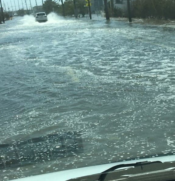
On the barrier island, a reader told Patch Route 35 southbound was flooded and the water was deep enough that vehicles were throwing off wakes as they drove along the middle of the lanes on the crest of the road.
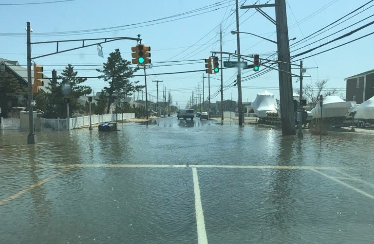
Water was several inches deep on Strickland Boulevard and on Kittiwake Boulevard, and the reader, who asked not to be identified, said water was covering Bay Boulevard on the mainland side of Barnegat Bay as well.
Find out what's happening in Toms Riverfor free with the latest updates from Patch.
Toms River police had received reports of flooding issues in the Green Island section of Toms River as well, said Ralph Stocco, the department spokesman.
Videos posted by a Patch reader on Twitter showed water coming over bulkheads and flooding roads in the Silverton section.
Find out what's happening in Toms Riverfor free with the latest updates from Patch.
"It's coming into houses again," said the reader, who goes by the Twittter handle @Hurricane Force1.
Heavy rain across the area brought with it thunderstorms and lightning that was blamed for damage to the Grenville Inn in Bay Head. At least 2 inches of rain fell across Ocean County in a four-hour span, according to the National Weather Service.
Back-bay flooding also was reported just up the road near Kettle Creek in Brick, where the water was continuing to rise more than two hours after the 1:10 p.m. high tide in the back bays had passed.

Flooding Barnegat Bay. Living on bay Toms River NJ streets flooded & water entering homes, again @weatherchannel @jenconnic @TomsRiverPatch pic.twitter.com/dXmuKXMt4t
— Hurricane Force (@HurricaneForce1) April 16, 2018
Barnegat Bay in Toms River NJ flooding @AMHQ @WickedTuna @News12NJ @ABC @TomsRiverPatch @DavePriceTV @NickGregoryFox5 @joecioffi pic.twitter.com/jxmXFcTTKg
— Hurricane Force (@HurricaneForce1) April 16, 2018
Photos provided by a Patch reader and published with permission
Get more local news delivered straight to your inbox. Sign up for free Patch newsletters and alerts.


