Weather
Snow, Bitter Cold In NJ New Year's Eve Weekend Forecast
Watch your driving: The roads could get a little slippery.

It won't be the great big storm that was originally predicted. But New Jerseyans could be in for some slippery conditions this weekend because of snow and bitter cold.
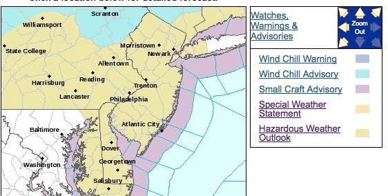
The National Weather Service has issued a hazardous weather outlook for the entire state, saying wind chill temperatures on Thursday morning will be as low as -5.
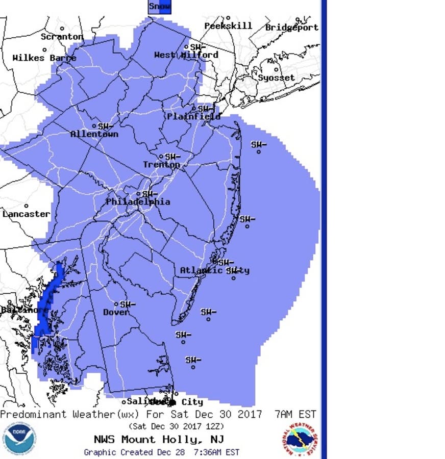
There is a chance for some accumulating snow Saturday, which could lead to slippery conditions. Nearly continuous subfreezing temperatures are expected throughout the weekend, with potential impact on unprotected infrastructure, according to the National Weather Service.
Find out what's happening in Toms Riverfor free with the latest updates from Patch.
The snow is expected to start after 1 a.m. on Saturday, and could reach its peak around 7 a.m. No more than an inch or two is expected - down from earlier predictions that said as many as 3 to 4 inches could fall.
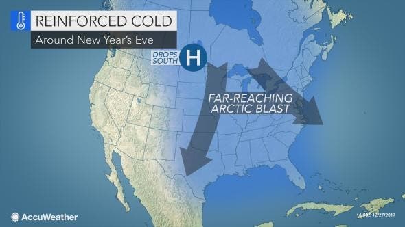
The bitter cold could lead to a big freeze, which could make roads slippery for drivers on their way to a New Year's Eve party on Sunday night, according to AccuWeather.
Find out what's happening in Toms Riverfor free with the latest updates from Patch.
RELATED: Prevent Your Pipes From Freezing During Brutal NJ Cold Snap
“Bitterly cold arctic air will settle in across a large swath of the U.S. as we turn the calendar from 2017 to 2018,” AccuWeather Senior Meteorologist Dan Pydynowski said in a release.
Frigid weather is expected to reach New York City and New Jersey just in time to chill those visiting Times Square, though the record low of -4 from 1918 will not be challenged, according to the release. Temperatures will be in the lower teens as the ball drops in Midtown Manhattan on Sunday night. At that level the temperature may be within the top two lowest since records have been maintained in the 1800s.
Here is the forecast:
- Thursday: Sunny, with a high near 20. Wind chill values as low as zero. Northwest wind 13 to 15 mph.
- Thursday night: Increasing clouds, with a low around 7. Wind chill values as low as zero. Northwest wind 5 to 11 mph.
- Friday: Mostly cloudy, with a high near 23. West wind 3 to 6 mph.
- Friday night: A chance of snow showers after 2am. Mostly cloudy, with a low around 14. Northwest wind 3 to 6 mph. Chance of precipitation is 30%. New snow accumulation of less than a half inch possible.
- Saturday: A chance of snow showers. Mostly cloudy, with a high near 28. West wind 3 to 6 mph. Chance of precipitation is 50%. New snow accumulation of less than a half inch possible.
- Saturday night: A chance of snow showers before 8pm. Mostly cloudy, with a low around 14. Chance of precipitation is 50%.
- Sunday: Mostly sunny, with a high near 21.
- Sunday night: Partly cloudy, with a low around 8.
NWS photo
Get more local news delivered straight to your inbox. Sign up for free Patch newsletters and alerts.