Weather
Snow In N.J. Tuesday; Another Storm Possible For Super Bowl Weekend
Snow began falling in New Jersey on Tuesday, and more is expected for Super Bowl weekend.

About an inch of snow could fall throughout New Jersey on Tuesday as a steady flurry began in some areas of North and Central Jersey, possibly making the state's roads very slick.
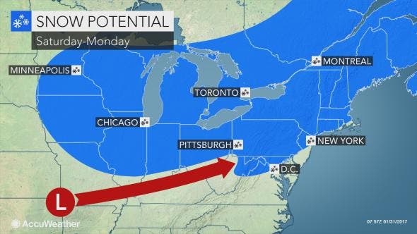
And forecasters are warning of the possibility of a Super Bowl weekend snowstorm - even though there is a "high forecast uncertainty" at this time, according to the National Weather Service.
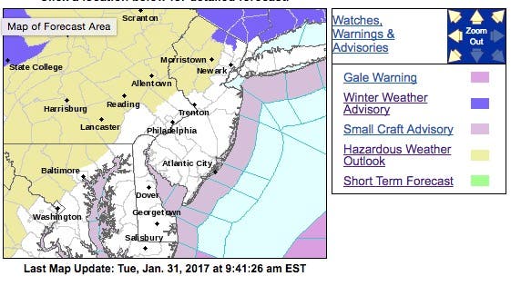
The NWS, which issued a hazardous weather outlook for parts of New Jersey, said another storm system may bring accumulation snow to the area late this weekend. "Snowfall accumulations will depend on the strength and track," the alert said.
Find out what's happening in Toms Riverfor free with the latest updates from Patch.
The timing of the storm could coincide with the Super Bowl, which begins just after 6 p.m. on Sunday.
Tuesday's snow — which is supposed to impact all areas of New Jersey, according to the NWS forecast — could change into rain, possibly by the time most drivers are returning home for work around 4 p.m.
Find out what's happening in Toms Riverfor free with the latest updates from Patch.
The snow was expected to begin late morning-midday and continue into the afternoon. Snowfall ranges are estimated at 1 to 1.5 inches. The system is expected to exit in the area of between 4 and 6 p.m., and overnight refreeze is a concern, said Jeffrey S. Paul, director of Morris County Office of Emergency Management.
Residents, meanwhile, are advised to monitor the forecast as the weekend gets closer because the current predictions on the storm are uncertain.
Forecasters with AccuWeather say the weekend storm could result in a few inches of snow or a rain/snow mix with little or no accumulation.
"As is often the case, February is shaping up to be quite stormy at times for parts of the central and eastern U.S. The risk of significant travel disruption will increase with each storm into the middle part of the month," AccuWeather said in a news release, noting there is a potential for a few inches of snow in the Philadelphia region this weekend.
As for this week, highs in the 40s are expected Wednesday and Thursday with temperatures dipping to the 30s later in the week.
Here is the forecast:
Tuesday: A chance of snow before 1 p.m., then possible High near 39. South wind 6 to 9 mph. Chance of precipitation is 80 percent. Total daytime snow accumulation of less than one inch possible.
Tuesday night: Mostly cloudy, with a low around 31. West wind 3 to 8 mph.
Wednesday: Mostly cloudy, with a high near 48. West wind 9 to 16 mph, with gusts as high as 30 mph.
Wednesday Night: Partly cloudy, with a low around 29. West wind 7 to 9 mph.
Thursday: Mostly sunny, with a high near 40. West wind 8 to 16 mph.
Thursday Night: Partly cloudy, with a low around 21.
Friday: Mostly sunny, with a high near 33.
Friday Night: Partly cloudy, with a low around 19.
Saturday: Sunny, with a high near 33.
Saturday Night: Partly cloudy, with a low around 20.
Sunday: A chance of rain and snow. Mostly cloudy, with a high near 35. Chance of precipitation is 30%.
Sunday Night: A chance of snow. Mostly cloudy, with a low around 27. Chance of precipitation is 30%.
Photo: Tom Davis
Get more local news delivered straight to your inbox. Sign up for free Patch newsletters and alerts.