Weather
Hazardous Weather Outlook Issued As Harvey Storms Head To N.J.
Harvey is expected to still pack a punch in New Jersey and Pennsylvania, and the National Weather Service has issued an alert.


A hazardous weather outlook has been issued as Harvey could still wield drenching downpours and gusty storms in New Jersey and Pennsylvania.
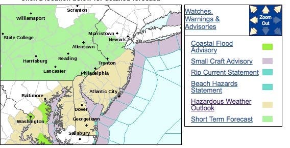
The hazardous weather outlook issued by the National Weather Service covers more than half of New Jersey as heavy rain overnight could lead to localized flooding, especially in areas of poor drainage, including urban areas.
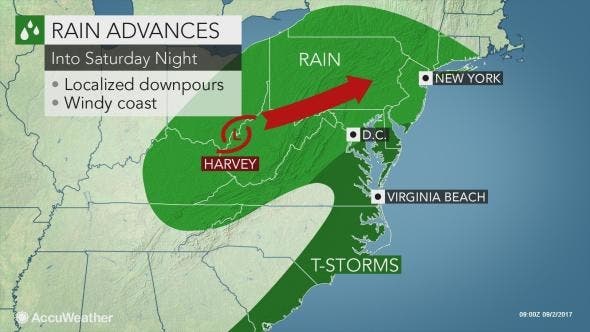
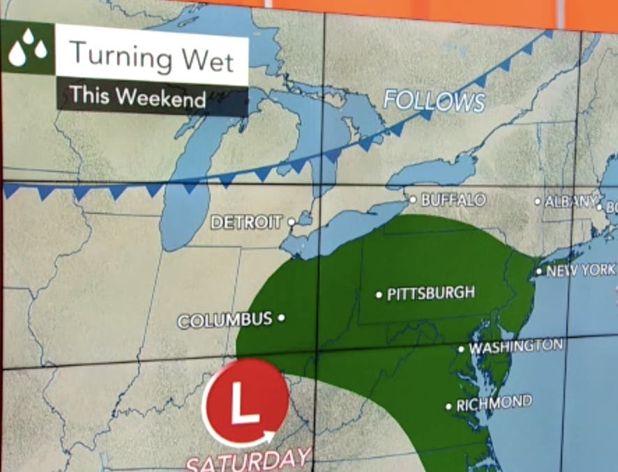
Rain is expected to spread over Pennsylvania and much of New Jersey on Saturday at night. During Saturday night, rain will advance into southern and western New York state and part of southwestern New England, according to an AccuWeather release.
Find out what's happening in Toms Riverfor free with the latest updates from Patch.
The National Weather Service also said there was a leading edge of an area of rain along a line extending from far western Berks County in Pennsylvania to Atlantic City and Ocean City in New Jersey, moving northeast at 30 mph.
Although there are a few embedded bands of heavier rain with rain amounts of up to one half inch, most locations will see less than one quarter inch with this first round of rain.
Find out what's happening in Toms Riverfor free with the latest updates from Patch.
Harvey is now well removed from the tropical air that helped to produce the flooding disaster in Texas and Louisiana. Much stronger steering winds in the Northeastern states will prevent Harvey from stalling like it did near the Gulf coast, according to the release.
Instead, the rainstorm will run into a swath of dry, cool air in New Jersey and Pennsylvania this weekend. The effect of the dry air will be not only to slow the forward progress of the rain initially but also to reduce the total amount of rain that falls from the storm, according to the release.
Motorists can expect wet travel and delays to expand slowly northeastward. Fans heading to area ball games should wear warm clothes and have a rain poncho handy. However, in isolated areas, tropical downpours can fall on parts of the region to cause incidents of flash and urban flooding, according to AccuWeather Chief Operating Officer Evan Myers. according to the release.
Here is the forecast:
- Saturday: A chance of showers, mainly after 4pm. Cloudy, with a high near 67. East wind 8 to 10 mph. Chance of precipitation is 30%. New precipitation amounts of less than a tenth of an inch possible.
- Saturday night: Showers likely, then showers and possibly a thunderstorm after 11pm. Low around 59. East wind 7 to 9 mph. Chance of precipitation is 90%. New rainfall amounts between a quarter and half of an inch possible.
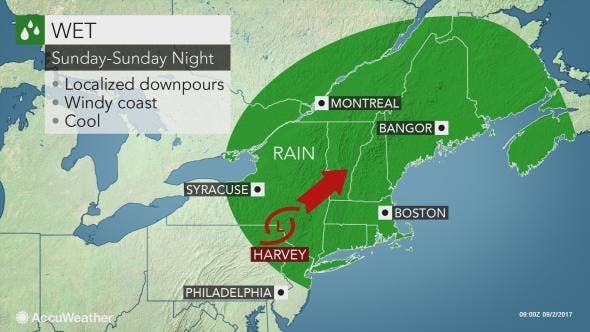
- SundayShowers likely, mainly before 7am. Mostly cloudy, with a high near 77. East wind 10 to 14 mph becoming west in the afternoon. Chance of precipitation is 60%. New precipitation amounts between a tenth and quarter of an inch possible.
Total rainfall will average 1-2 inches with locally higher amounts.
"Flooding downpours are most likely to occur over the Appalachians, where hilly terrain can increase threat of rapid runoff," Myers said in the release.
Another area where isolated flooding downpours are possible is from eastern North Carolina and Virginia to Delaware and southern New Jersey, where higher humidity and warmth from the Atlantic Ocean may enhance thunderstorms, according to the release.
Some of the storms in coastal areas of the mid-Atlantic can be locally gusty into Saturday evening, according to AccuWeather Storm Warning Meteorologist Richard Schraeger.
Patch file photo
Get more local news delivered straight to your inbox. Sign up for free Patch newsletters and alerts.


