Community Corner
The Floods in Pakistan, Relatively Speaking
Interactive graphic by BBC overlays map of disasters, events with local zip codes

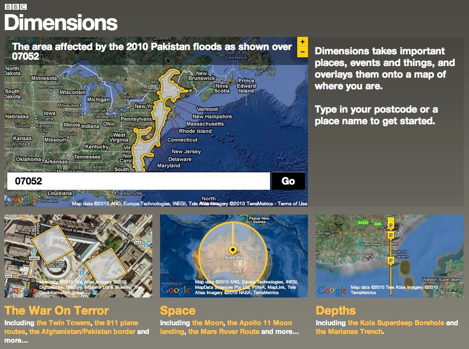
Weeks of relentless rain and heavy winds have caused some of the worst flooding in Pakistan in history. Crops are destroyed, sectors of the country's infrastructure and industry are crippled and, according to a New York Times report Wednesday morning, at least 800,000 Pakistani residents are stranded and accessible only by air.
More than 17 million Pakistanis have been affected by the flooding, and national news organizations have posited that the floods are, perhaps, the worst ever to affect the Southeast Asian country.
To put those superlatives in perspective, the BBC created an interactive graphic that overlays the extent of the flooding onto maps of local zip codes, including West Orange. It is the latest creation in the BBC's "Dimensions" project.
Find out what's happening in West Orangefor free with the latest updates from Patch.
A number of charity organizations are coordinating donations and relief efforts for Pakistan, including the Red Cross and the U.S. Fund for UNICEF. To learn more, click here or speak with your local community service or religious organization.
The project also includes perspectives on other disasters, such as the oil spill in the Gulf of Mexico, which, according to Dimensions, would stretch from East Stroudburg, Pa., to Norwalk, Conn, encompassing West Orange.
Find out what's happening in West Orangefor free with the latest updates from Patch.
Dimensions also includes comparing the size of ancient worlds, festivals, battles and depths.
— Joshua Wilwohl contributed to this report.
Get more local news delivered straight to your inbox. Sign up for free Patch newsletters and alerts.