Weather
Snow Estimates Increase: Hudson Valley's Weather
The National Weather Service has revised snow total estimates for Monday. Sigh.

The most recent advisories fro the National Weather Service have increased the amount of possible snow for the Hudson Valley. Earlier Sunday, the NWS said that Orange and Putnam counties could see 3 to 5 inches of snow. Now that same estimate applies to Putnam and Westchester counties.
- Orange-Putnam-Rockland-Westchester Winter Weather Advisory: 2 a.m. to 2 p.m. Monday, 3-5 inches possible
- Dutchess-Ulster Hazardous Weather Outlook, 2-4 inches possible
Hudson Valley Weather said areas south of I-84 could see the higher accumulation.
"Snow develops after midnight tonight, and a snowy Monday AM commute is likely... before the snow tapers off before noon," Hudson Valley Weather said on Facebook.
Find out what's happening in Bedford-Katonahfor free with the latest updates from Patch.
"While accumulating snow is typically hard to come by in the springtime as temperatures inch upwards, any snow falling overnight will have an easier time sticking to roads and sidewalks," AccuWeather Meteorologist Faith Eherts says.
Temperatures will approach 50 degrees in the Hudson Valley during the afternoon on Easter Sunday, but don't skimp on a coat if you will be out late. The temperature will dip to the low 30s by midnight, setting the stage for snow to arrive a few hours later.
Find out what's happening in Bedford-Katonahfor free with the latest updates from Patch.
"It appears most likely that most, if not all, precipitation should be done by mid-day Monday, if not sooner," the NWS says.
Here are the latest snowfall estimate maps from the National Weather Service:
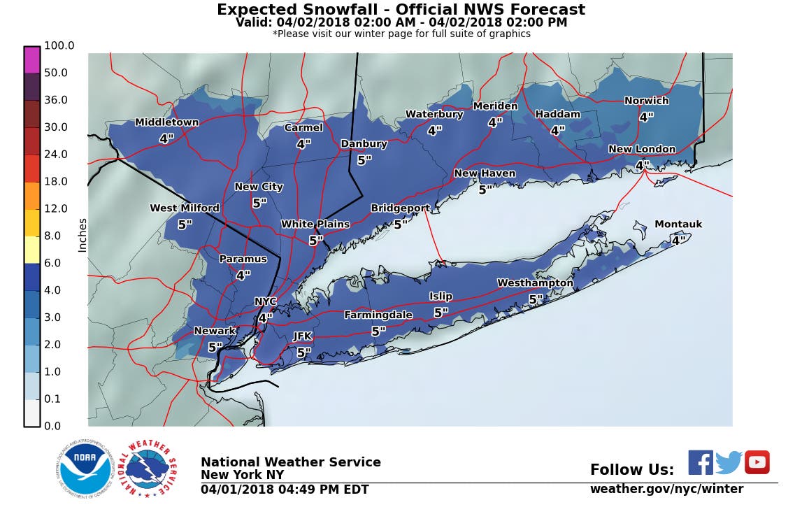
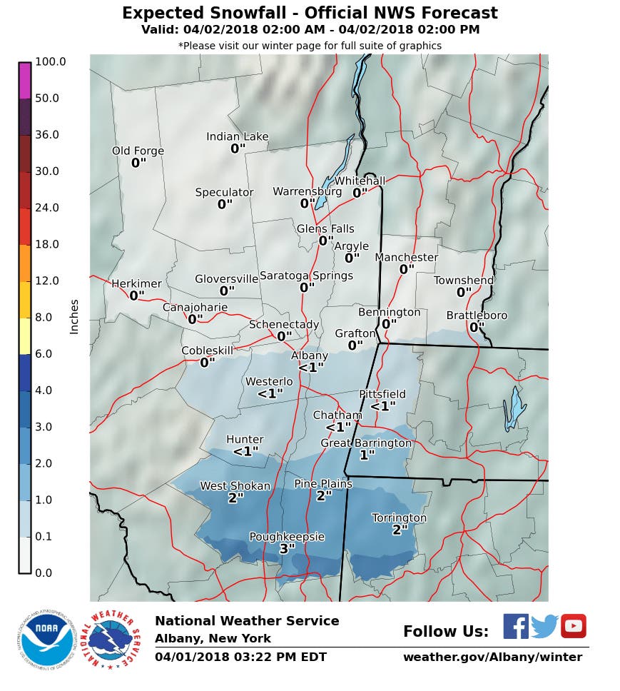
Image via Shutterstock.
Get more local news delivered straight to your inbox. Sign up for free Patch newsletters and alerts.