Weather
Snow Expected Before Possible Weekend Storm In Hudson Valley
The jury is still out about what exactly might happen for the weekend, but for Thursday night into Friday, snow sounds likely.

HUDSON VALLEY, NY — For those of you who were longing for winter to finally arrive, you may just be in luck. Snow is in the forecast for Thursday night into Friday for the lower Hudson up to the mid-Hudson Valley.
For Westchester, Putnam and Rockland counties, the National Weather Service said there could be from 1 to 3 inches of snow Thursday night, starting after 10 p.m. Then snow is forecast during the morning commute Friday in the northern parts of the region, but a wintry mix in southern Westchester.
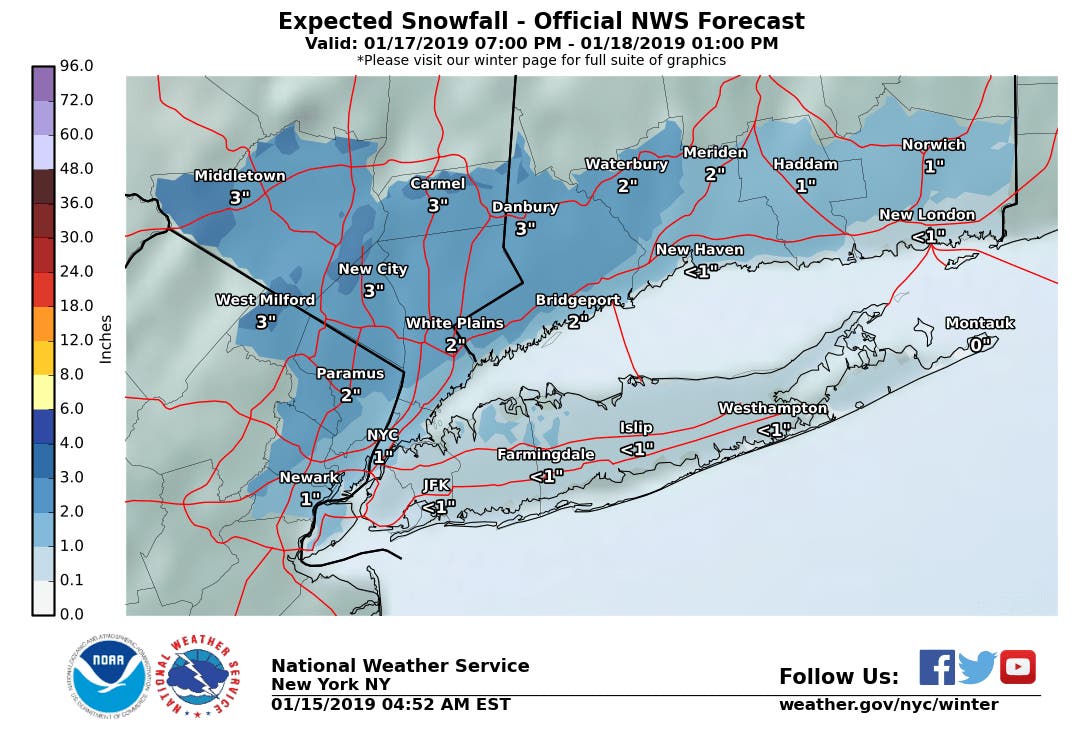
Only for Columbia, Dutchess and Ulster did the NWS issue a hazardous weather outlook for Thursday night into Friday morning.
Find out what's happening in Bedford-Katonahfor free with the latest updates from Patch.

Fortunately, it warms up to the high 30s, low 40s for the rest of the day Friday.
And then there's the talk about the weekend.
Find out what's happening in Bedford-Katonahfor free with the latest updates from Patch.
There is, according to the NWS, the potential for a significant winter weather event this weekend, with Saturday afternoon as the arrival time. However, its meteorologists said there is still relatively low certainty about the details of precipitation types and potential impacts.
Alex Marra and Bill Potter, of Hudson Valley Weather, are saying it's too early to say whether the region will see a wintry mix or a mostly snow event.
"At this point… it's probably a 50/50 toss up, between which scenario is more likely," they said. "What is quite unlikely… is that this storm completely misses us."
Here's a closer look at what to expect for southern Westchester from the NWS:
- Tuesday Afternoon: Mostly sunny, with a high near 35. Northwest wind around 6 mph.
- Tuesday Night: Mostly clear, with a low around 23. Calm wind becoming west around 6 mph after midnight.
- Wednesday: Mostly sunny, with a high near 39. Wind chill values between 15 and 25. West wind 7 to 14 mph.
- Wednesday Night: Partly cloudy, with a low around 20. West wind 8 to 10 mph.
- Thursday: Partly sunny, with a high near 30. North wind around 6 mph becoming calm in the morning.
- Thursday Night: Snow, mainly after 10pm. Temperature rising to around 32 by 5am. Chance of precipitation is 80%. New snow accumulation of 1 to 3 inches possible.
- Friday: A chance of rain, snow, and freezing rain before 7am, then a chance of rain and snow between 7am and 10am. Mostly cloudy, with a high near 41. Chance of precipitation is 40%.
- Friday Night: Partly cloudy, with a low around 24.
- Saturday: A 30 percent chance of snow after 4pm. Partly sunny, with a high near 34.
- Saturday Night: Snow before midnight, then rain and snow between midnight and 3am, then rain after 3am. Low around 27. Chance of precipitation is 90%.
- Sunday: Rain, freezing rain, and sleet. High near 36. Chance of precipitation is 90%.
- Sunday Night: A 30 percent chance of snow showers. Mostly cloudy, with a low around 9.
Get up-to-date weather forecasts via Patch’s news alerts right in your inbox. Find and “Like” Hudson Valley Patches' Facebook Pages.
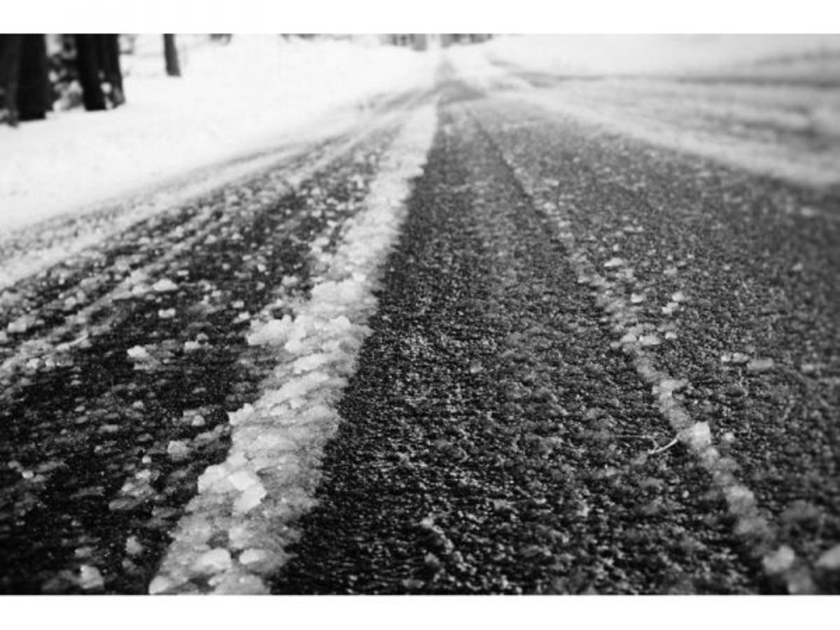
Image via Shutterstock.
Get more local news delivered straight to your inbox. Sign up for free Patch newsletters and alerts.