Home & Garden
Snow Possible Sunday Night for Lower Hudson Valley
The next big storm system could move through Tuesday into Wednesday.


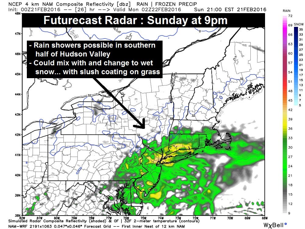
The lower Hudson Valley is looking at mild temperatures again Sunday, though it will not be as mild as Saturday was.
The tricky problem for today’s weather is what will happen when a cold front moves in toward evening.
“Clouds will increase during the day, and limit our afternoon sun to some extent. We still expect afternoon highs right around 50°. But the interesting situation occurs as evening approaches. A cold front will usher in some colder air… just as a weak wave of low pressure passes by to our south. The result could be some rain showers mixing with wet snow,” said Bill Potter of Hudson Valley Weather.
Find out what's happening in Bedford-Katonahfor free with the latest updates from Patch.
According to the National Weather Service, the southern-most areas of the Hudson Valley will see a chance of rain, while further north there is a chance of rain turning to snow.
Highs Sunday will be in low- to mid-50s and will dip down to the low- to mid-30s. Monday’s forecast calls for mostly sunny skies and temps in the mid- to upper-40s.
Find out what's happening in Bedford-Katonahfor free with the latest updates from Patch.
The next chance for snow and/or rain will be Tuesday night into Wednesday, but it’s too early to be certain exactly what that system will bring.
Map: Hudson Valley Weather.
Get more local news delivered straight to your inbox. Sign up for free Patch newsletters and alerts.