Home & Garden
WEATHER ALERT: Hazardous Weather Outlook Issued for Westchester, Rockland and Putnam
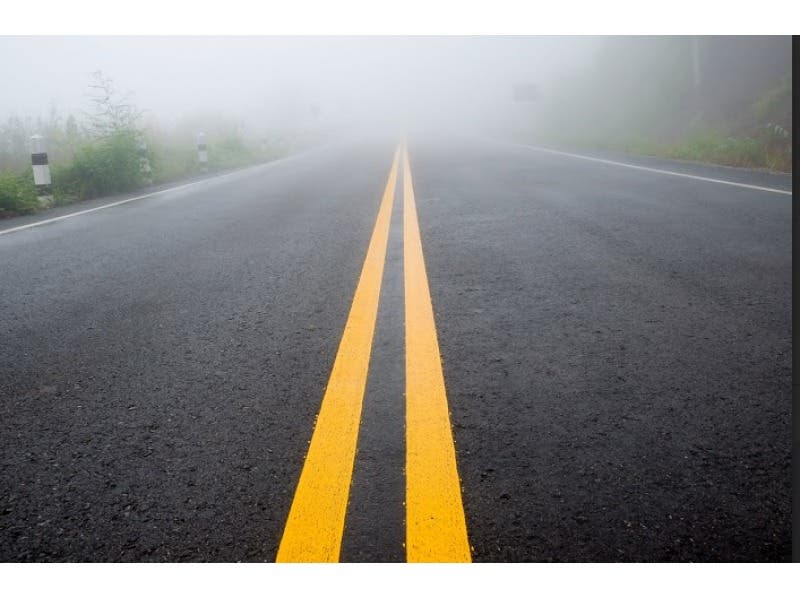
The National Weather Service cautions that dense fog could impact travel and we'll let you know when.

Written by BRIAN MCCREADY (Patch Staff)
We’re in the midst of unbelievable early December weather with temperatures in the mid 50s and likely to reach - and possibly exceed - 60 degrees by the weekend. But the National Weather Service has just issued a “Hazardous Weather Outlook” for all of Westchester, Rockland and Putnam counties.
The hazardous weather outlook pertains to fog that is expected to begin rolling in late this afternoon and stick around throughout the night and into the morning hours.
Find out what's happening in Bedford-Katonahfor free with the latest updates from Patch.
If you’re driving tonight or early on Friday the National Weather Service writes, “patchy dense fog with visibilities quarter mile or less is possible after midnight tonight and through daybreak Friday.”
The National Weather Service adds that the dense fog could last through 8 a.m. which could have an impact on Friday’s morning commute.
Find out what's happening in Bedford-Katonahfor free with the latest updates from Patch.
As for the weekend, more unseasonably warm weather, with sunny skies and temperatures in upper 50s to low 60s forecast for both Saturday and Sunday. Records could be broken this weekend, forecasters say.
Daytime temperatures next week are forecast to continue to remain over 50 degrees too.
Patch Editor Alfred Branch contributed to this report.
Photo credit: Shutterstock
Get more local news delivered straight to your inbox. Sign up for free Patch newsletters and alerts.