Home & Garden
Winter Weather Advisory Issued for Friday, Snow Total Estimates Rise Throughout Lower Hudson Valley
The forecast changed from earlier Thursday into something that could produce up to 5 or more inches.

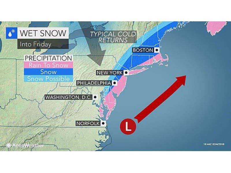
A surprise snow event could be in the works for Rockland, Putnam and Westchester counties.
The National Weather Service has issued a Winter Weather Advisory from 1 a.m. to 10 a.m. Friday.
Bill Potter of HudsonValleyWeather.com said the timeline is for the snow to start from south to north between midnight and 3 a.m.
Find out what's happening in Bedford-Katonahfor free with the latest updates from Patch.
Moderate to heavy snow is expected to fall near and south of I-84 from 3 a.m. to 8 a.m., with snow tapering from west to east between 6 a.m. and 10 a.m.
Potter said a frontal boundary stalled off the east coast.
Find out what's happening in Bedford-Katonahfor free with the latest updates from Patch.
“A piece of energy is going to interact with that boundary Thursday night,” he said. “This will form a coastal storm east of Virginia. The latest data on Thursday has begun to identify how much moisture is available off the east coast … and is now supporting the idea that the snow pushes into the Hudson Valley.”
And the accumulations are a mixed bag.
The National Weather Service is now saying New City, Peekskill and Yorktown can expect up to 4 inches of snow by the time it ends Friday morning, with White Plains, Bedford, Brewster and Rye getting up to 5 inches.
Map: Accuweather.com
Get more local news delivered straight to your inbox. Sign up for free Patch newsletters and alerts.