Weather
Rest-of-the-Weekend Weather for Southern Westchester
Here's what's coming after the storm ends Saturday afternoon: precipitation.


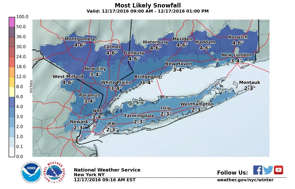
It's a weekend of precipitation — in all the ways we can get it. Snow, sleet, freezing rain, rain, drizzle, fog...this weekend in southern Westchester's got it all.
On Saturday, the National Weather Service says the region could see up to 1/10th inch of ice on top of its 3-8 inches of snow.
"Beware of driving or walking. Surfaces will be slippery," the NWS says.
Find out what's happening in Harrisonfor free with the latest updates from Patch.
Take care when traveling during inclement weather- allow for additional travel time. Use caution when entering/exiting trains, on platforms.
— Metro-North Railroad (@MetroNorth) December 17, 2016
Then on Sunday, another batch of rain and wintry mix is poised to blow warmly through the Hudson Valley before another blast of Arctic air heads our way.
Here's the forecast for the rest of the weekend for southern Westchester:
Find out what's happening in Harrisonfor free with the latest updates from Patch.
This Afternoon
A chance of light rain with possible freezing rain...drizzle and freezing drizzle likely. Patchy fog. Additional ice accumulation around a trace. Near steady temperature in the lower 30s. Southwest winds 5 to 10 mph. Chance of precipitation 60 percent.
Tonight
Cloudy with patchy drizzle. A chance of light rain... Mainly after midnight. Patchy fog. Lows in the mid 30s. Temperature rising into the lower 40s after midnight. Southwest winds 10 to 15 mph. Chance of rain 50 percent.
Sunday
Rain. Patchy fog in the morning. Not as cool with highs in the lower 50s. Temperature falling into the mid 40s in the afternoon. Southwest winds around 15 mph...becoming west in the afternoon. Gusts up to 25 mph. Chance of rain 80 percent.
Sunday Night
Mostly cloudy in the evening...then becoming partly cloudy. Lows in the lower 20s. Northwest winds 10 to 15 mph with gusts up to 25 mph.
Monday
Mostly sunny. Much cooler with highs in the lower 30s. North winds 5 to 10 mph.
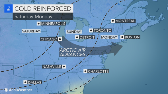
Images: NWS, AccuWeather.com
Get more local news delivered straight to your inbox. Sign up for free Patch newsletters and alerts.