Weather
Forecasters Offer More Details On Possible Weekend Snow In HV
How close to the coast the storm gets will determine where it will snow and where it will rain.


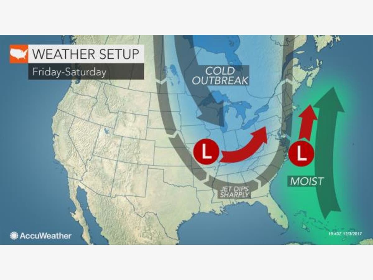
HUDSON VALLEY, NY — New details about a potential storm that could bring the first snow of the season to the Hudson Valley by the end of the week have been released by forecasters. With the jet stream dipping sharply into the U.S. and moisture coming from the Atlantic Ocean there is a chance for wintry precipitation along the I-95 corridor from Friday to Saturday.
The National Weather Service said the probability of snow in southern Westchester now exists before 3 p.m. Friday, as well as into Friday night. The chance of snow is 30 percent.
Forecasters are also calling for a 30 percent chance of snow Saturday after 2 p.m. and into Saturday night. Further north in the Hudson Valley there is also a chance of snow beginning Friday and lasting into Saturday.
Find out what's happening in Larchmont-Mamaroneckfor free with the latest updates from Patch.
How close to the coast the storm gets will determine where it will snow and where it will rain.
“At the very least, we believe there will be some sort of wintry precipitation in the Northeast,” said AccuWeather Chief Meteorologist Elliot Abrams.
Find out what's happening in Larchmont-Mamaroneckfor free with the latest updates from Patch.
And because there’s always another scenario, if the coastal storm merges with another weak storm coming in from the Midwest, a major storm could materialize.
AccuWeather said that in the merger scenario, heavy snow could fall north and west of the I-95 major cities with rain “along the coast and a wintry mix in between.”
As a result, there could be significant travel disruptions.
Check back with Patch for updates.
Map: AccuWeather.com.
Get more local news delivered straight to your inbox. Sign up for free Patch newsletters and alerts.