Weather
Wind Advisory Wednesday In The Hudson Valley
Winds this strong are capable of downing small tree limbs and causing isolated power outages. And they're bringing the cold back.

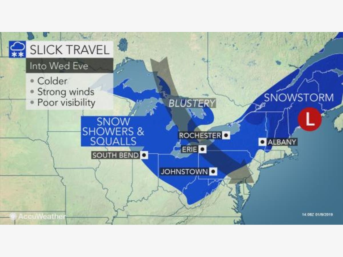
High winds may be most of what the Hudson Valley sees of the powerful storm dumping snow upstate. However, we'll get the after-effect: cold.
"Dramatic weather changes are in store as temperatures crash in a matter of hours," according to AccuWeather Chief Meteorologist Elliot Abrams. Compared to Tuesday afternoon, AccuWeather RealFeel® Temperatures will be 30-40 degrees lower during Wednesday night and Thursday.
The National Weather Service reminds us that that strong winds can cause power outages.
Find out what's happening in Mid Hudson Valleyfor free with the latest updates from Patch.
For Dutchess and Ulster counties, there's a Wind Advisory in effect until 8 p.m.
* Winds...West 15 to 25 mph with gusts up to 50 mph.
* Timing...This morning into this evening.
* Impacts...Strong winds may knock down large tree limbs and afew trees as well. Isolated power outages are possible.
PRECAUTIONARY/PREPAREDNESS ACTIONS...
A Wind Advisory means that sustained winds of 31 to 39 mph are expected, with gusts between 46 to 57 mph. Winds this strong are capable of downing small tree limbs and branches, possibly causing isolated power outages. Driving can also be difficult, especially for high profile vehicles. Use extra caution.
The winds won't be as powerful in Orange, Putnam Rockland, and Westchester counties, but the National Weather Service did post a Special Weather Statement:
Find out what's happening in Mid Hudson Valleyfor free with the latest updates from Patch.
Gusty west winds will develop early this morning across the Tri- State and continue through the entire day. Wind gusts of 30 to 40 mph are expected. These gusts could bring down isolated small tree limbs and possibly some power lines. These gusts could continue into Thursday.
Get more local news delivered straight to your inbox. Sign up for free Patch newsletters and alerts.