Weather
Hazardous Weather Outlook Issued for Rockland County as Hurricane Matthew Makes Landfall in Haiti
Local meteorologists say Nanuet is likely to receive some impact from Hurricane Matthew. Here is the latest update.

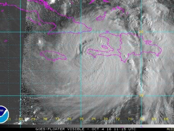
NANUET, NY — Hurricane Matthew appears more likely to make a landfall in the U.S. by this weekend, as the dangerous storm slammed into Les Anglais, Haiti, early Tuesday morning.
According to the National Hurricane Center, Matthew remained a strong Category 4 storm with 145 mph maximum sustained winds.
Gusty winds and heavy rain are a possibility for Orange, Putnam, Rockland and Westchester counties, as the massive storm is expected to pass off well to the east of Nantucket.
Find out what's happening in Nanuetfor free with the latest updates from Patch.
Already, the National Weather Service has issued a Hazardous Weather Outlook for the lower Hudson Valley for this upcoming weekend in relation to the impacts Matthew may have on the region.
The weather service states that Matthew is expected to be just off the southeast coast on Saturday but there is still “much uncertainty with the track of this system as we head into the weekend and too early to mention specific impacts.”
Find out what's happening in Nanuetfor free with the latest updates from Patch.
The folks at Hudson Valley Weather are tracking Matthew very closely. Tuesday to Friday is a critical period, said meteorologist Bill Potter, because in that period meteorologists will be looking closely at how fast the hurricane is moving and evaluating the different models for its direction
"Will Matthew zip up the east coast, and merge with a cold front to bring tropical rains to the Hudson Valley? Or will Matthew slow down, and get caught up in the trough, and ushered out to sea near North Carolina?" Potter said onhudsonvalleyweather.com. "There are many solutions possible… and timing is very critical. So it’s best to stay posted for now. Ultimately, the earliest we would feel any impacts from Matthew, would be late on Saturday… so we’ve got a couple days to iron things out."
SEE ALSO: New Long-Range New York Winter Forecast Released, and It's Not Good
The hurricane center anticipates tropical storm or hurricane watches will likely be issued for most of Florida's Atlantic coast at some point on Tuesday. Florida and North Carolina have issued a state of emergency.
The current forecast may mean significant impacts to Georgia, South Carolina and the Mid-Atlantic states, as well. Hurricane Matthew was located about 10 miles east of Tiburon, Haiti, as of the hurricane center’s 8 a.m. Tuesday update. The storm was moving north at 9 mph.
The system is expected to move near eastern Cuba after clearing Haiti. Forecasters say the storm is expected to turn northwest Wednesday night, putting it on a trek to run the coastline of Florida, Georgia and the Carolinas.
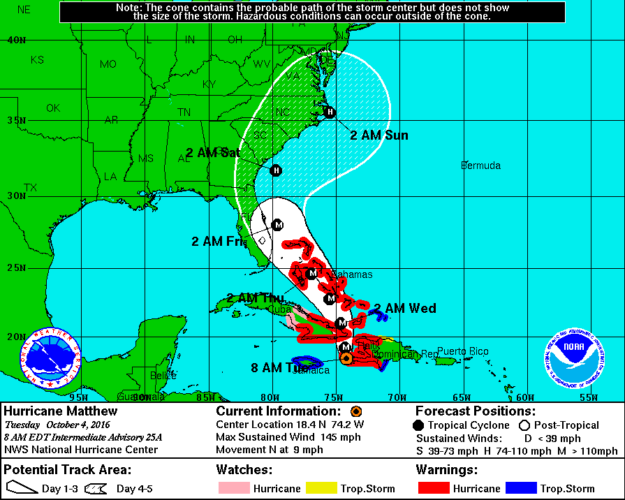
Options for Hurricane Matthews path include a landfall in the Carolinas, a northward turn along the Atlantic Seaboard, or a curve out to sea late this weekend, according to AccuWeather.com.
There's at least a chance of tropical storm-force winds and heavy rain for the Mid-Atlantic and New England coast, with significant wind and rain threats even if the storm stays far offshore, according to The Weather Channel.
On Tuesday morning, hurricane-force winds were extending out from Matthew up to 40 miles. Tropical storm-force winds extended out 185 miles.
Hurricane Matthew’s formation came during the peak of the 2016 Atlantic Hurricane Season. Forecasters at the hurricane center say the eight-week period that begins in mid-August and runs through mid-October is a “season within the season.” This eight-week period “is often the most active and dangerous time for tropical cyclone activity,” NOAA explained on its website.
The eight-week period is historically responsible for major spikes in tropical weather activity, NOAA said. In fact, it accounts for about 78 percent of all tropical storm days on record. It is also the period when 87 percent of the category 1 and 2 hurricane days on record occurred. In addition, this period is responsible for “a whopping 96 percent of the major (category 3, 4 and 5) hurricane days.”
With reporting by Sherri Lonon and Greg Hambrick | Graphics courtesy of NOAA
Get more local news delivered straight to your inbox. Sign up for free Patch newsletters and alerts.
