Weather
Hazardous Weather Outlook Kicks off Work Week for Nanuet
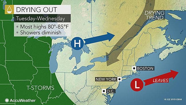
While there are some chances for storms, overall this week will feel cooler and there will be plenty of sunshine around Nanuet.

The weather forecast for the Hudson Valley this week includes a few chances for showers and storms in the five-day forecast.
In fact, the National Weather Service has kicked things off with a Hazardous Weather Outlook for Orange, Putnam, Rockland and northern Westchester counties:
THERE IS A LOW CHANCE FOR LOCALIZED FLASH FLOODING. RECENT HEAVY RAINFALL IN ASSOCIATION WITH ADDITIONAL LOCALLY HEAVY RAINFALL IN SHOWERS AND THUNDERSTORMS THIS AFTERNOON INTO THIS EVENING COULD LEAD TO LOCALIZED FLASH FLOODING.
Find out what's happening in Nanuetfor free with the latest updates from Patch.
But top news for the week is that temperatures will be much cooler, and all in all it looks pretty good.
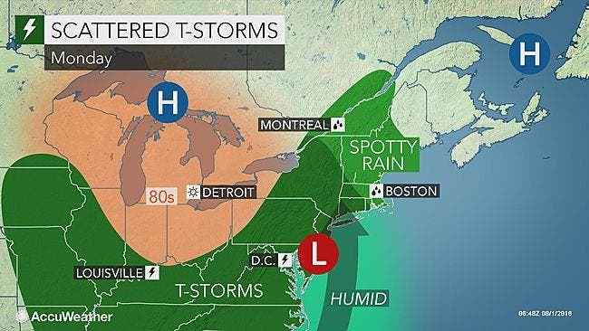
Yes, the days of possible stormy weather include Monday, Tuesday, Friday night, and Saturday. While that sounds like a lot, the chance for storms on each of those days is around 40 percent or less currently.
So as typical with storms, some people may receive a downpour and some will see sunny skies.
Find out what's happening in Nanuetfor free with the latest updates from Patch.
- RECOMMENDED READING: Crane Collapse/ Senior Sex/ Missing Teen: the Month in Review
Here's the NWS forecast for the next five days for Rockland:
Today
Cloudy. A slight chance of showers this morning...then a chance of showers with isolated thunderstorms this afternoon. Highs in the upper 70s. East winds around 5 mph. Chance of rain 30 percent.
Tonight
Mostly cloudy with a chance of showers. Isolated thunderstorms in the evening. Humid with lows in the mid 60s. East winds around 5 mph. Chance of rain 50 percent.
Tuesday
Partly sunny with a slight chance of showers. Isolated thunderstorms in the afternoon. Highs in the upper 70s. Northeast winds around 5 mph. Chance of rain 20 percent.
Tuesday Night
Partly cloudy. Lows in the lower 60s. Northeast winds around 5 mph.
Wednesday
Mostly sunny. Highs around 80. East winds around 5 mph...becoming southeast around 5 mph in the afternoon.
Wednesday Night
Partly cloudy. Lows in the mid 60s.
Thursday
Mostly sunny. Highs in the mid 80s.
Thursday Night
Partly cloudy. Lows in the mid 60s.
Friday
Mostly sunny. Highs in the upper 80s.
Friday Night
Partly cloudy in the evening...then becoming mostly cloudy. A chance of showers and thunderstorms. Lows in the upper 60s. Chance of rain 30 percent.
GRAPHICS: AccuWeather.com
Get more local news delivered straight to your inbox. Sign up for free Patch newsletters and alerts.
