Weather
NYC Under Winter Weather Advisory As Snow, Sleet And Ice Loom
A winter storm heading toward New York City is expected to bring a wintry mix starting Thursday at 10 p.m., forecasters warn.

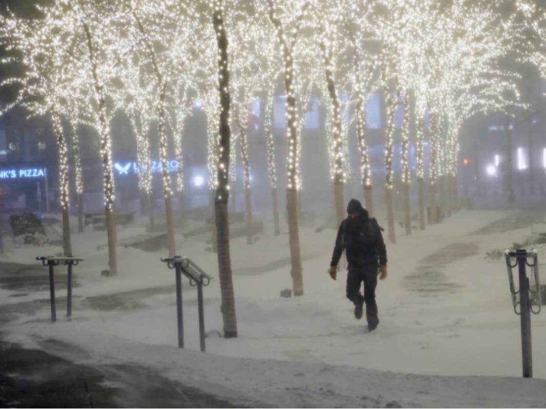
NEW YORK CITY — Looming winter weather could encase New York City in a sheath of ice, on top of 3 inches of snow and sleet, forecasters warn.
The city is under a winter weather advisory starting Thursday at 10 p.m., according to the National Weather Service.
A significant winter storm blowing in from the Rockies will reach the East Coast by late Thursday and bring a mix of precipitation to the city, forecasters said.
Find out what's happening in New York Cityfor free with the latest updates from Patch.
“Total combined snow and sleet accumulations of 1 to 3 inches and ice accumulations of up to one tenth of an inch,” the advisory states.
Snow is likely before Friday at 1 a.m., when it will mix with sleet, according to the forecast. Freezing rain and sleet are likely after 4 a.m., the forecast states.
Find out what's happening in New York Cityfor free with the latest updates from Patch.
The chance of precipitation Friday is 100 percent, according to the forecast.
The expected wintry weather is a far cry from the balmy temperatures Wednesday that brought New Yorkers outside for an early taste of spring. No day in the coming week looks to reach that day’s highs of 68 degrees, according to the forecast.
Here’s the complete National Weather Service forecast:
Thursday
Mostly cloudy, with a high near 38. Wind chill values between 25 and 30. North wind 7 to 10 mph.
Thursday Night
Snow likely before 1am, then snow and sleet between 1am and 4am, then freezing rain and sleet after 4am. Low around 31. Wind chill values between 20 and 25. East wind 9 to 13 mph. Chance of precipitation is 100%. New ice accumulation of less than a 0.1 of an inch possible. New snow and sleet accumulation of 1 to 2 inches possible.
Friday
Freezing rain before 10am, then rain between 10am and 4pm. High near 39. Wind chill values between 25 and 35. Light and variable wind becoming west 10 to 15 mph in the afternoon. Winds could gust as high as 25 mph. Chance of precipitation is 100%. Little or no ice accumulation expected.
Friday Night
Partly cloudy, with a low around 22. Wind chill values between 15 and 20. Northwest wind 10 to 15 mph.
Saturday
Mostly sunny, with a high near 36. Northwest wind 8 to 10 mph.
Saturday Night
Mostly clear, with a low around 27.
Sunday
Sunny, with a high near 43.
Sunday Night
Partly cloudy, with a low around 22.
Monday
Sunny, with a high near 32.
Monday Night
Partly cloudy, with a low around 24.
Tuesday
Partly sunny, with a high near 41.
Tuesday Night
Mostly cloudy, with a low around 30.
Wednesday
Mostly sunny, with a high near 46.
Get more local news delivered straight to your inbox. Sign up for free Patch newsletters and alerts.