Weather
Winter Storm Blanketed NYC In Up To 19 Inches Of Snow
New Yorkers are urged to avoid non-essential travel as crews dig out city from massive Nor'Easter's snowfall.

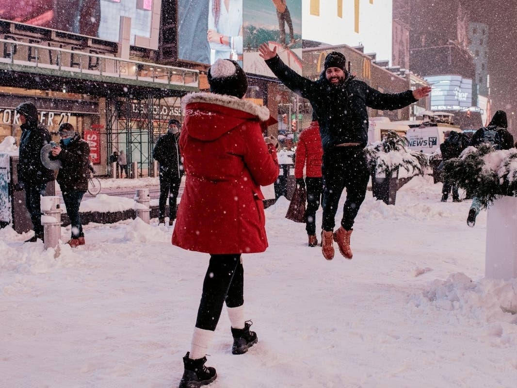
NEW YORK CITY — A heavy blanket of snow up to 19 inches deep will keep New York City's daily life on ice for hours to come.
Snow showers are likely Tuesday but the massive Nor'Easter that struck the city has largely blown away, according to the National Weather Service.
City crews worked round the clock to clear roads throughout the storm, and will continue Tuesday. Gov. Andrew Cuomo's office urged New Yorkers to avoid non-essential travel, even as above-ground subways reopened from their storm-forced hiatus.
Find out what's happening in New York Cityfor free with the latest updates from Patch.
"As the storm makes its way through the region, we continue to urge residents to remain vigilant, avoid unnecessary travel and check in with family and friends," Cuomo said in a statement issued late Monday.
The weather system stood as the most significant winter storm to hit the city in years, prompting officials to declare a state of emergency, ban non-essential road travel, cancel in-person classes at schools and halt some subway and commuter trains.
Find out what's happening in New York Cityfor free with the latest updates from Patch.
Snowfall tallies show that East Tremont in the Bronx had the highest reported snowfall in the city at 19 inches.
Other reported snowfalls are:
Brooklyn
- Coney Island — 16 inches
- Flatbush — 15.4 inches
- Flatbush — 15 inches
- Crown Heights — 14 inches
Manhattan
- Central Park — 16.3 inches
- Greenwich Village — 14 inches
- "North New York" — 12.3 inches
Queens
- Bellerose Manor — 18.5 inches
- LaGuardia Airport — 12.7 inches
- JFK Airport — 11.7 inches
Staten Island
- Westerleigh — 15 inches
Above ground subways restarted service Tuesday at 5 a.m., while commuter LIRR and Metro-North trains did so at 4 a.m., according to the governor's office.
The city's buses are running at 75 percent service.
Crews continue to clear streets and motorists are urged to avoid driving.
"Exercise caution if you must head out," tweeted the city's emergency management department. "Allow for additional travel time and anticipate delays. If you have to drive, drive slowly. Use mass transportation, if possible."
Snow removal operations are ongoing. Exercise caution if you must head out. Allow for additional travel time and anticipate delays. If you have to drive, drive slowly. Use mass transportation, if possible. #StaySafeNYC pic.twitter.com/LLYXYThLOD
— NYC Emergency Management (@nycemergencymgt) February 2, 2021
The forecast doesn't call for significant additional snow, but winter weather appears likely to stick around for a couple days.
Here's the National Weather Service forecast:
Tuesday
Snow showers likely. Cloudy, with a high near 36. Wind chill values between 20 and 25. Breezy, with a north wind 18 to 21 mph, with gusts as high as 31 mph. Chance of precipitation is 70%. Total daytime snow accumulation of less than a half inch possible.
Tuesday night
A 40 percent chance of snow showers, mainly before midnight. Cloudy, with a low around 31. Wind chill values between 20 and 25. Blustery, with a north wind 15 to 20 mph.
Wednesday
A 20 percent chance of snow showers before 1pm. Mostly cloudy, with a high near 36. Wind chill values between 20 and 25. Northwest wind 14 to 17 mph.
Wednesday night
Partly cloudy, with a low around 29. Wind chill values between 20 and 25. Northwest wind 11 to 14 mph.
Thursday
Sunny, with a high near 38. Northwest wind 8 to 13 mph.
Get more local news delivered straight to your inbox. Sign up for free Patch newsletters and alerts.