Weather
Chance Of Flurries Over Frigid Hudson Valley Weekend
Wind chills will keep everyone shivering Saturday and Sunday.

HUDSON VALLEY, NY — Not used to chilly? Well, get the scarves and hats back out. The National Weather Service says cold will persist through the weekend.
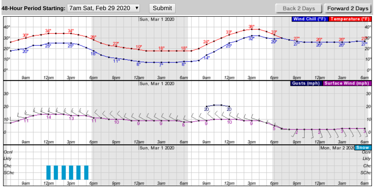
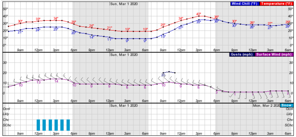
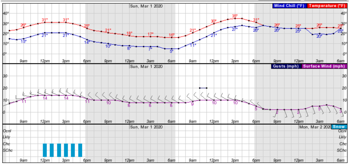
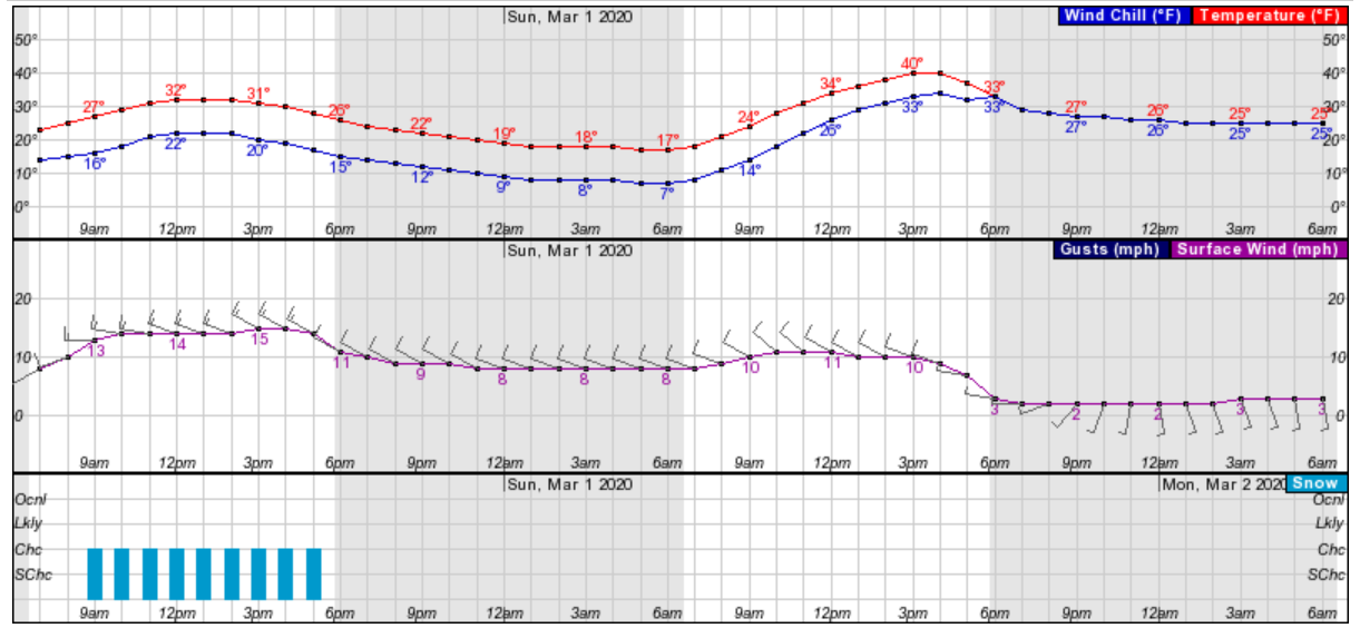
Plus, snow flurries are possible Saturday afternoon in Westchester, Rockland, Putnam and Orange counties. Snow showers are possible in Dutchess and Ulster counties.
Saturday will see temperatures below normal, with highs in the 30s but wind chill factors into the 20s in the day time, then diving at night. Slightly warmer, but still below normal temperatures are forecast for Sunday, with wind chill factors still keeping that freezing feeling until the late afternoon.
Find out what's happening in New Cityfor free with the latest updates from Patch.
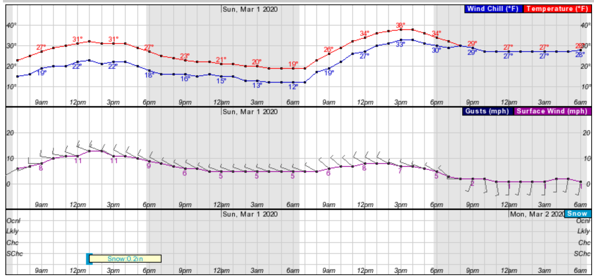
In northern Westchester:
For Rockland:
Find out what's happening in New Cityfor free with the latest updates from Patch.
For Putnam County:
For Orange County:
For Dutchess:
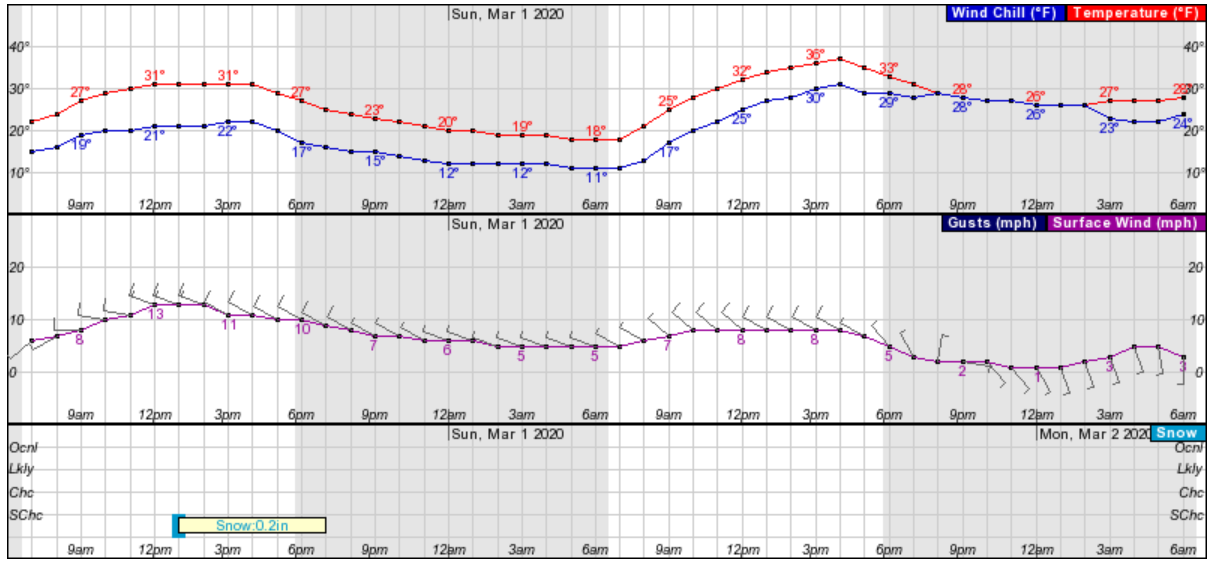
For Ulster:
"But by Monday, winds shift around to the SW and milder air returns to the region for the start of the work week… with highs back into the upper 40s and low 50s," said Alex Marra and Bill Potter of Hudson Valley Weather.
Get more local news delivered straight to your inbox. Sign up for free Patch newsletters and alerts.