Weather
Hazardous Weather Outlook Issued For Hudson Valley
Separate announcements were made for the lower and mid Hudson Valley counties.

HUDSON VALLEY, NY — The National Weather Service issued one hazardous weather outlook for Orange, Putnam, Rockland and Westchester counties:
There is a risk for scattered strong to severe thunderstorms to move through the region this afternoon into early this evening with a cold frontal passage. The primary threat will be strong to damaging wind gusts. The thunderstorms may also produce frequent lightning and large hail.
The rough timing of thunderstorms this afternoon into early evening is:
- Lower Hudson Valley and Interior Connecticut: 3-6pm
- Northeast NJ, NYC and Coastal Connecticut: 4-7pm
- Long Island: 5-8pm.
Another outlook was issued for Dutchess and Ulster counties:
Find out what's happening in New Cityfor free with the latest updates from Patch.
Scattered to numerous thunderstorms are expected today, especially this afternoon. There is a slight risk for severe thunderstorms, with damaging winds and large hail possible. In addition, isolated flooding is possible in urban, poor drainage and low lying areas from locally heavy downpours.
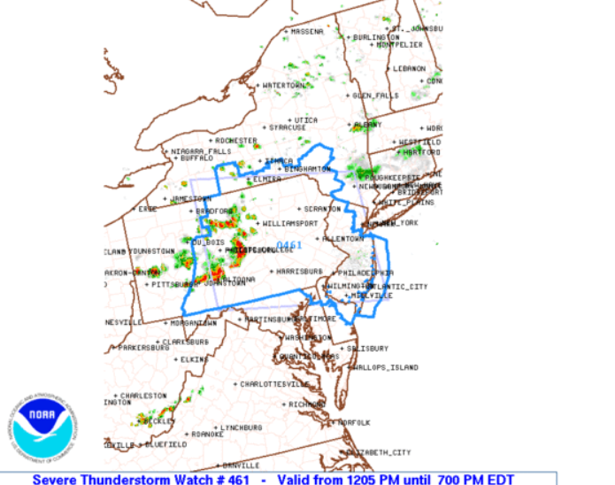
There's a severe thunderstorm watch for south-central New York. The Hudson Valley is not included at this time.
Find out what's happening in New Cityfor free with the latest updates from Patch.
Get more local news delivered straight to your inbox. Sign up for free Patch newsletters and alerts.