Weather
Hudson Valley Weekend: Gusty Winds, Elevated Fire Risk
The Hudson Valley was spared the brunt of the coastal storm bringing bombogenesis and 100 mph winds over the Atlantic Ocean.

HUDSON VALLEY, NY — There's an elevated fire risk across the Hudson Valley, and the National Weather Service has issued special weather statements. One for Orange, Putnam, Rockland and Westchester:
A dry air mass will combine with gusty northerly winds to create conditions more conducive for fire spread today. Relative humidity is expected to decrease to 20-25 percent with wind gusts of 25 to 35 mph today. These conditions would likely aid fire spread if ignition occurs.
And one for Dutchess, Ulster and Columbia:
Conditions have been fairly dry recently in the Capital District, Mid Hudson Valley, and Taconics, with little to no snow on the ground. Northerly winds gusting to around 25 mph through the early afternoon combined with relative humidity values falling below 30 percent in the afternoon and the dry conditions will contribute to an elevated risk of fire spread today.
The Hudson Valley is fortunate that the storm off the East Coast didn't get any closer. It's that situation classified as "bombogenesis."
Find out what's happening in New Cityfor free with the latest updates from Patch.
We officially have #bombogenesis https://t.co/6IwrQXC9fg
— Miguel Pierre (@mpierre19) March 7, 2020
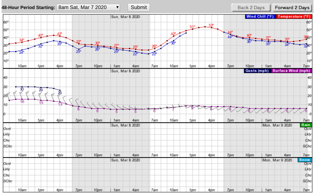
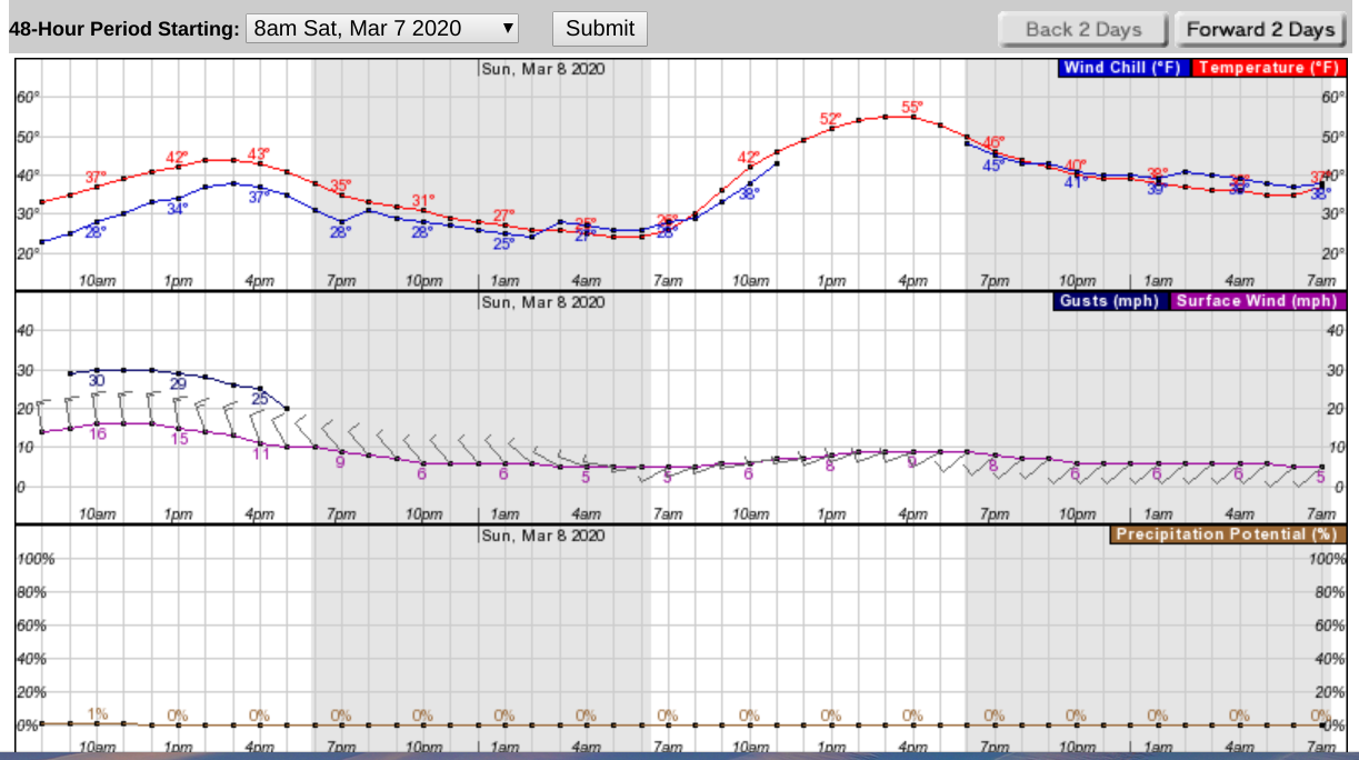
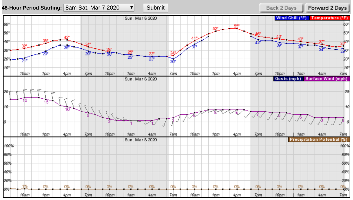
But the winds should diminish Saturday afternoon. On Sunday, we'll see warmer temperatures. Here's what the next 48 hours look like:
In Northern Westchester:
Find out what's happening in New Cityfor free with the latest updates from Patch.
In Rockland:
In Dutchess:
Get more local news delivered straight to your inbox. Sign up for free Patch newsletters and alerts.