Weather
Two-Part Hazardous Weather Outlook: Hudson Valley Forecast
Gusty winds and heavy rain precede a winter storm bearing ice and snow from the Midwest.

HUDSON VALLEY, NY — Two storm systems this week are expected to hit the region hard enough that the National Weather Service has issued a two-part hazardous outlook for the mid-Hudson Valley.
"Another week, another frontal boundary, another risk of Rain, Snow, Sleet and Freezing Rain," said Alex Marra and Bill Potter of Hudson Valley Weather, pointing out that this scenario "has played out numerous times this winter, most recently during the major ice storm that impacted parts of the region."
First, strong gusty southeast to south winds are expected Tuesday evening. Wind gusts of 35 to 45 mph are possible, especially across the higher terrain around the Taconics and eastern Catskills.
Find out what's happening in New Cityfor free with the latest updates from Patch.
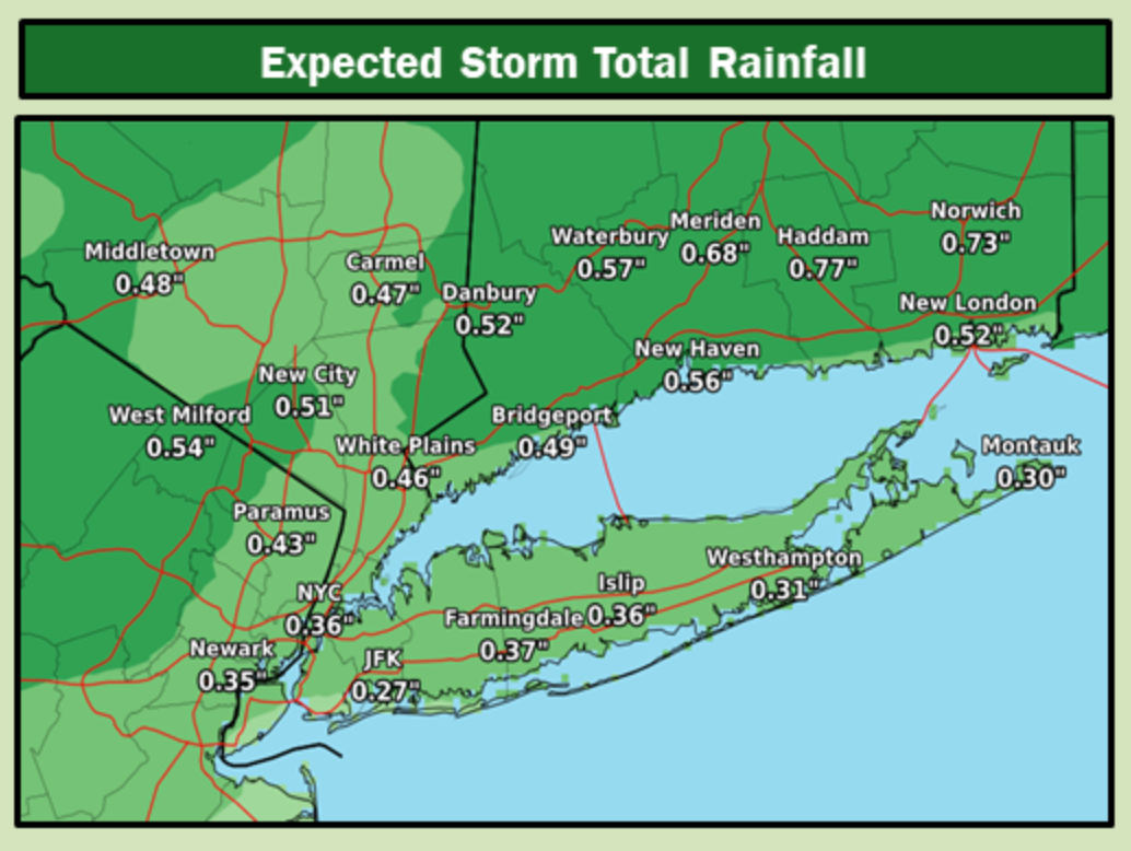
Local rainfall Tuesday:
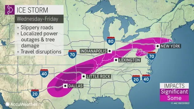
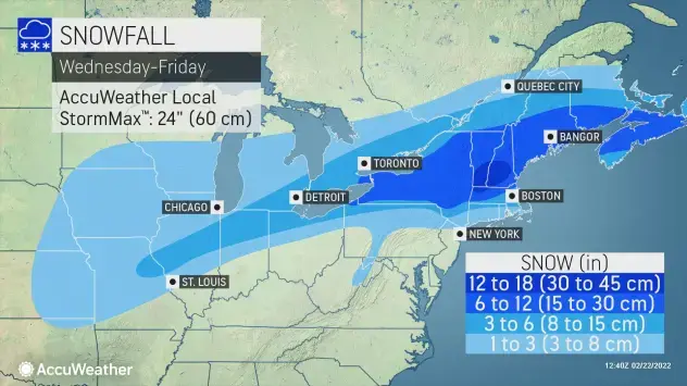
Then, ice and snow are expected Thursday night into Friday, with moderate to heavy accumulation possible. A Winter Storm Watch will likely be needed over portions of the region, the NWS said.
Find out what's happening in New Cityfor free with the latest updates from Patch.
It's too early for a complete forecast, Hudson Valley Weather pointed out on Facebook. "What we can confidently say that it’s best to factor into your plans a heavy impact on both Friday commutes due to the potential for multiple types of winter precipitation. Just who gets what type and how much will likely be determined on a north to south gradient across the region."
Disruptions to cross-country travel and shipping due to snow and ice are likely, said Alex Sosnowski, AccuWeather senior meteorologist.
This week's wild weather pattern includes a period of temperatures 10-25 degrees above average on the East Coast and 20 to 45 degrees below average on the Plains, the National Weather Service said.
Note the temperature drop in the local five-day forecast, shown here based on Brewster:
- Tuesday Afternoon - A chance of showers before 4pm, then rain after 4pm. High near 55. Southeast wind 5 to 11 mph, with gusts as high as 29 mph. Chance of precipitation is 80%. New precipitation amounts between a quarter and half of an inch possible.
- Tonight - Rain, mainly before 11pm. Steady temperature around 54. South wind 9 to 16 mph, with gusts as high as 33 mph. Chance of precipitation is 100%. New precipitation amounts between a quarter and half of an inch possible.
- Wednesday - A 30 percent chance of showers before 1pm. Cloudy through mid morning, then gradual clearing, with a high near 65. Southwest wind 9 to 14 mph becoming northwest in the afternoon.
- Wednesday Night - Increasing clouds, with a low around 24. North wind 9 to 13 mph.
- Thursday - A 20 percent chance of snow after 1pm. Mostly cloudy, with a high near 36. North wind around 6 mph.
- Thursday Night - Snow. Low around 27. Chance of precipitation is 100%. New snow accumulation of 1 to 3 inches possible.
- Friday - Snow before 9am, then snow and sleet between 9am and 11am, then rain after 11am. High near 38. Chance of precipitation is 100%.
- Friday Night - A 30 percent chance of snow before 7pm. Partly cloudy, with a low around 15.
- Saturday - Sunny, with a high near 33.
- Saturday Night - Mostly clear, with a low around 18.
Get more local news delivered straight to your inbox. Sign up for free Patch newsletters and alerts.