The National Weather Service has updated its Hazardous Weather Outlook for Putnam, Rockland and Westchester counties.
They're still calling for snow overnight Sunday to Monday:
A LIGHT SNOWFALL EVENT IS FORECAST TONIGHT WITH 1 TO 3 INCHES OF ACCUMULATION. THIS WILL RESULT IN SLIPPERY ROAD CONDITIONS.
Find out what's happening in New Cityfor free with the latest updates from Patch.
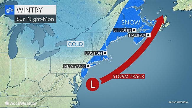
"This will be another extremely close call for the Hudson Valley, but has all the warning signs of the previous storms we have seen (or haven’t seen) this winter," said Bill Potter of Hudson Valley Weather. "The Hudson Valley projects to be on the extreme NW edge of the storm, and based on how the models have handled these situations all winter, this means most of the HV will see little if any snow."
Sunday will be cold, but snow will probably not start falling until after sunset. Road conditions will be slippery for the Monday morning commute, forecasters say.
Find out what's happening in New Cityfor free with the latest updates from Patch.
MAP: AccuWeather.com
Get more local news delivered straight to your inbox. Sign up for free Patch newsletters and alerts.