Weather
Storms Headed To Hudson Valley, Hazardous Outlook Issued
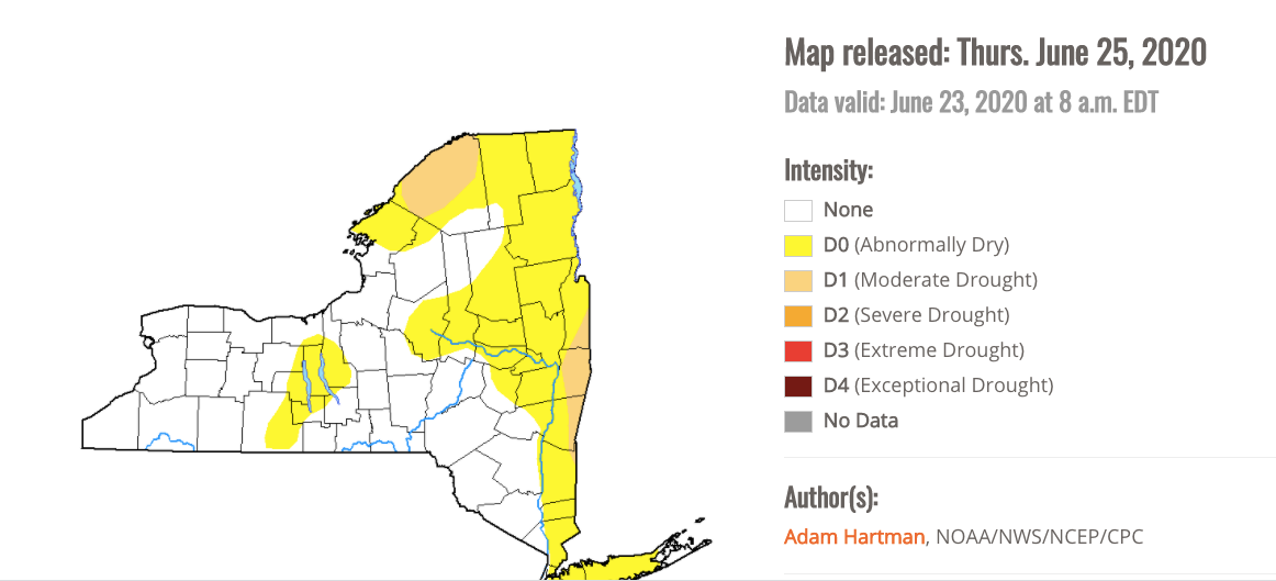
The whole east side of the Hudson Valley is abnormally dry, according to the state Drought Monitor.

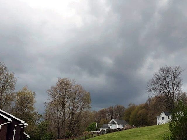
HUDSON VALLEY, NY — Hazardous weather outlooks have been issued for Dutchess, Orange, Putnam, Rockland, Ulster and Westchester counties. Rain is in the forecast, and people couldn't be happier.
"It's been a very dry period around the Hudson Valley. For more than a month, the region has seen less than half the normal rainfall," said Hudson Valley Weather on Facebook. "Much of the area is approaching drought conditions as a result."
Only two days into summer, in the town of Carmel in Putnam County, two water districts have declared a Water Emergency. All non-essential uses of water are prohibited including watering gardens, all car and building washing, lawn-watering and filling of swimming pools. It is unlawful for any person to use water supplied by Carmel Water Districts #7 and #12 for a non-essential purpose. The Town Police Department will be enforcing these prohibitions.
Find out what's happening in New Cityfor free with the latest updates from Patch.
According to the National Weather Service, a warm front will move north through the area Saturday morning into the early afternoon bringing scattered showers and embedded thunderstorms. Additional thunderstorms are possible later this afternoon into evening, some of which could become strong to severe. Damaging wind gusts are the primary threat.
The Storm Prediction Center has put Dutchess and Ulster in a marginal to slight risk for severe thunderstorms due to the potential for damaging winds and large hail.
Find out what's happening in New Cityfor free with the latest updates from Patch.
In addition, some locally heavy rainfall may occur with the thunderstorms which may lead to ponding of water on roadways and poor drainage flooding of low lying areas.
The frontal passage will leave a very warm and humid airmass in place through Sunday. Scattered thunderstorms are likely Sunday afternoon into evening, with a few of those potentially becoming severe.
High temperatures will generally be in the lower to mid 80s Saturday, and mid to upper 80s on Sunday. Temps in northeastern NJ and NYC will be close to 90 both days. Overnight temperatures temps will be warm and muggy, in the mid 60s to lower 70s.
Get more local news delivered straight to your inbox. Sign up for free Patch newsletters and alerts.