Weather
Storm Ends, Brutal Cold Next In The Hudson Valley
Don't relax Tuesday night as the snow tapers off. The NWS predicts dangerous wind chills Wednesday-Friday.

HUDSON VALLEY, NY — Get through the commute Tuesday, and get any shoveling done. Because Wednesday brings gusty winds, snow showers and the temperatures are going to drop and drop again to the point where frostbite and hypothermia are real, fast threats, forecasters say.
The snow in Dutchess and Ulster will taper off before dawn Wednesday. However, it'll be heaviest, up to an inch per hour, during the evening commute between 4 PM and 9 PM. From 3-7 inches are possible.
A bit of warm air in Orange, Putnam, Rockland and northern Westchester could bring rain. Then the precipitation returns to all snow later Tuesday evening before ending late tonight into early Wednesday morning. From 2-5 inches are possible.
Find out what's happening in Nyack-Piermontfor free with the latest updates from Patch.
"The roads and other surfaces are very cold after two nights of lows in the teens, this means that at the onset of snowfall, travel will get slick quite quickly and only worsen where snow continues to fall," said Alex Marra and Bill Potter of Hudson Valley Weather. "Areas that do transition to rain also have another threat to contend with. Cold air will once again crash in behind this system tomorrow night. Areas where rain is falling will transition back to a period of snow, and yes you guessed it, flash freeze again."
Then, the National Weather Service says dangerous to life-threatening wind chills leading to frostbite/hypothermia are a threat for all of eastern New York Wednesday night through Friday morning.
Find out what's happening in Nyack-Piermontfor free with the latest updates from Patch.
An arctic front crosses the area Wednesday afternoon, bringing with it gusty winds and a chance of snow showers. As an arctic airmass settles over the region, temperatures will fall into the single digits to around zero by early Thursday morning. A few below zero temperatures are possible well north and west of New York City. Wind chill values early Thursday morning will range from 10 to 20 degrees below zero and will only rise to around zero during the day on Thursday.
You know the routine.
"We are experts now at this smorgasboard of precipitation, we either leave the snow to get rained on and then frozen into permafrost that must be removed with hydronic fluid powered equipment, or we attack it before," Marra and Potter said. "Work smarter not harder! Also keep in mind that the winds and temps behind this storm will once again be brutal! Be prepared."
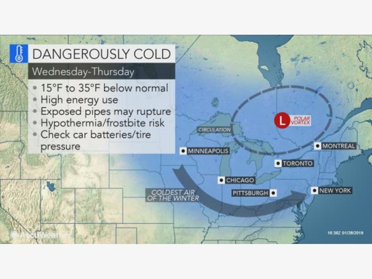
Also, AccuWeather meteorologists warned that motorists should prep their cars carefully and travel with a winter survival kit in the event their vehicle breaks down, and they are forced to wait for help. Plus, they said, residents responsible for their own heat should ensure that they have enough propane, wood pellets and/or firewood to last.
Image via AccuWeather.com
Get more local news delivered straight to your inbox. Sign up for free Patch newsletters and alerts.

