Community Corner
Winter Storm Warning Issued For Part Of Hudson Valley
Here's the latest on the wintry mix of snow, sleet, freezing rain and rain descending on the region.

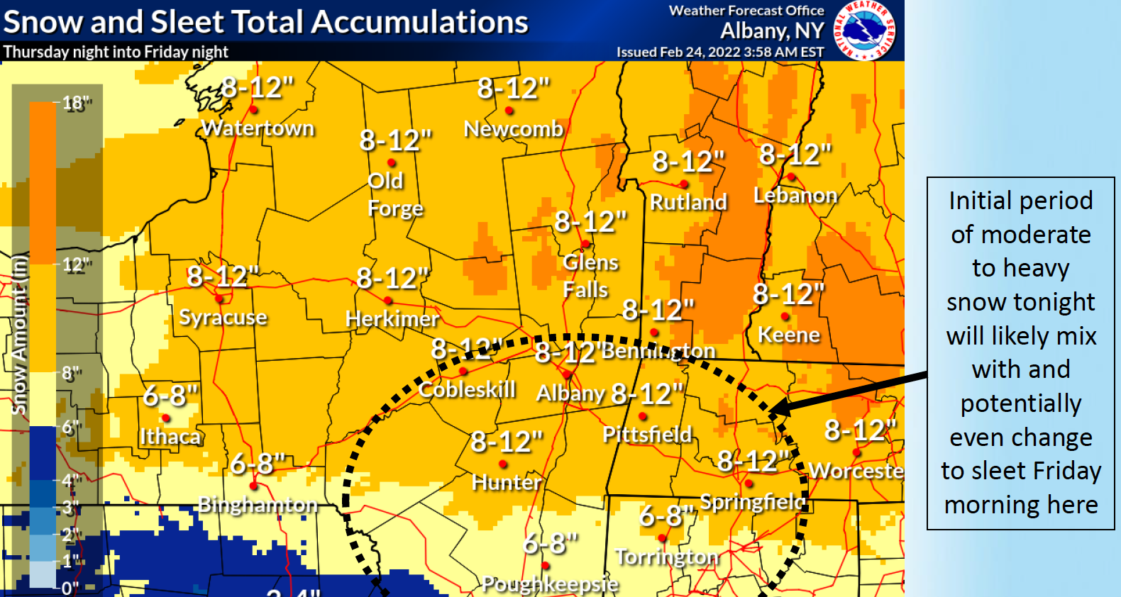
HUDSON VALLEY, NY — A winter storm warning has been issued for Dutchess and Ulster counties, as the National Weather Service firmed up its regional forecast of snow and sleet coated with ice to fall Thursday through Friday morning.
- In the mid-Hudson, snowfall rates may reach or even exceed 1” per hour at times overnight.
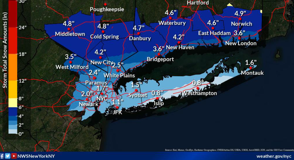
- The winter weather advisory for Orange, Putnam, Rockland and northern Westchester has been narrowed. It will be in effect from 10 p.m. Thursday to 1 p.m. Friday, by which time residents can expect combined snow and sleet accumulations to total 3 to 6 inches with ice accumulations of around one-tenth of an inch.
- Southern Westchester can expect the same amount of ice, on top of total combined snow and sleet accumulations of 1 to 3 inches.
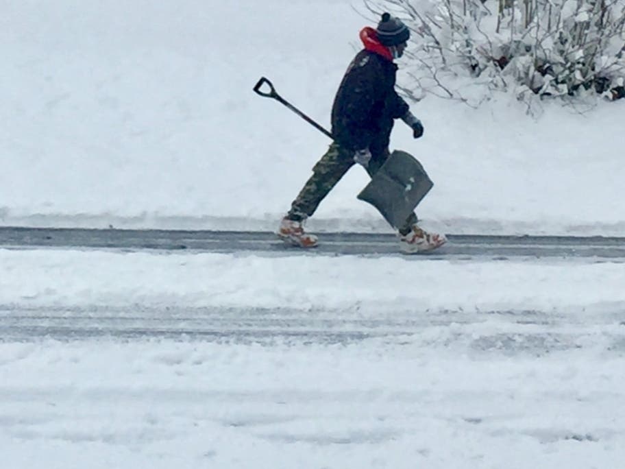
Communities are warned that the storm will create very difficult travel conditions due to reduced visibility and snow- and sleet-covered roadways. SEE: Croton Changes Trash Pickup Due To Winter Storm Street Conditions
"Since sleet has the potential to cool road surfaces more quickly than snow, some roads can be slippery as a result before rain takes over," said Alex Sosnowski, AccuWeather senior meteorologist.
Find out what's happening in Nyack-Piermontfor free with the latest updates from Patch.
Temperatures could be slashed by as much as 40 degrees in just 24 hours across the path of the massive storm, plummeting locally from Wednesday's far-above-average high in the 60s.
Find out what's happening in Nyack-Piermontfor free with the latest updates from Patch.
Will things stay frozen?
Overnight Thursday, temperatures will be in the 20s. And while temps will be in the mid-30s on Friday, they could drop into the teens Friday night. Daytime temps will be in the 30s on Saturday and 40s on Sunday but drop below freezing on Monday.
Here's the five-day forecast based on Rockland County from the NWS:
- Thursday - Mostly cloudy. Much cooler with highs in the mid 30s. Northeast winds 5 to 10 mph.
- Tonight - A chance of snow in the evening, then snow after midnight. Snow accumulation of 2 to 4 inches. Lows in the upper 20s. East winds 5 to 10 mph. Gusts up to 20 mph after midnight. Chance of snow near 100 percent.
- Friday - Freezing rain and sleet in the morning, then a chance of rain in the afternoon. Total sleet accumulation of 3 to 5 inches. Ice accumulation around a tenth of an inch. Highs in the upper 30s. East winds 5 to 10 mph, becoming west in the afternoon. Gusts up to 20 mph. Chance of precipitation near 100 percent.
- Friday Night - Partly cloudy. Lows around 17. Northwest winds 5 to 10 mph. Gusts up to 20 mph in the evening.
- Saturday - Mostly sunny. Highs in the lower 30s. Northwest winds 5 to 10 mph.
- Saturday Night - Mostly clear. Lows in the lower 20s.
- Sunday - Sunny. Highs around 40.
- Sunday Night - Partly cloudy in the evening, then clearing. Lows 15 to 20.
- Monday - Sunny. Highs in the upper 20s.
Check back with Patch for more winter storm updates.
Get more local news delivered straight to your inbox. Sign up for free Patch newsletters and alerts.