Weather
Hudson Valley Heat Index Projections Top 100 Degrees: NWS
Check out the National Weather Service's maps, they're full of angry reds. Here's the latest on the heatwave.

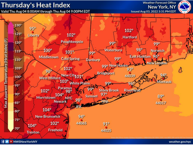
HUDSON VALLEY, NY — Hot and humid and dirty air, that's what we've got for the end of the work week in the Hudson Valley. The temperatures will be in the 90s but it'll feel much worse, with heat advisories out and an air quality alert from 11 a.m. to 11 p.m.
How oppressive are we expecting? Here are two examples: the Nyack Farmers Market will shut down at noon and Pleasantville Village Hall will be closed from 12-2 p.m. Thursday.
Find out what's happening in Ossining-Croton-On-Hudsonfor free with the latest updates from Patch.
Things will become barely less oppressive on Friday, the National Weather Service said — just look at Poughkeepsie, where the heat index drops from 102 to 101, or White Plains, where it drops from 101 to 98.
"Even if temperatures are slightly lower than Thursday, the combination of heat and humidity will still make for a very uncomfortable day, particularly for those who are working or exercising outdoors and for indoor places that lack air conditioning," said Ryan Adamson, AccuWeather meteorologist.
Find out what's happening in Ossining-Croton-On-Hudsonfor free with the latest updates from Patch.
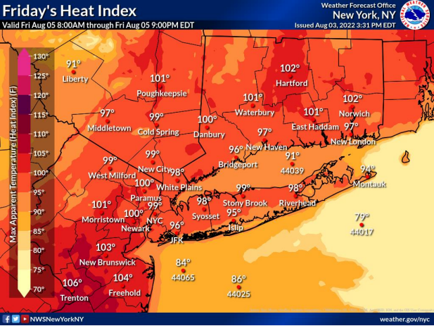
Still, the actual temperature will drop from high to low 90s on Friday, and the chance of precipitation is up to 60 percent, in the form of thunderstorms and showers in the evening. Not a lot of rain is expected, though - maybe a tenth to a quarter of an inch.
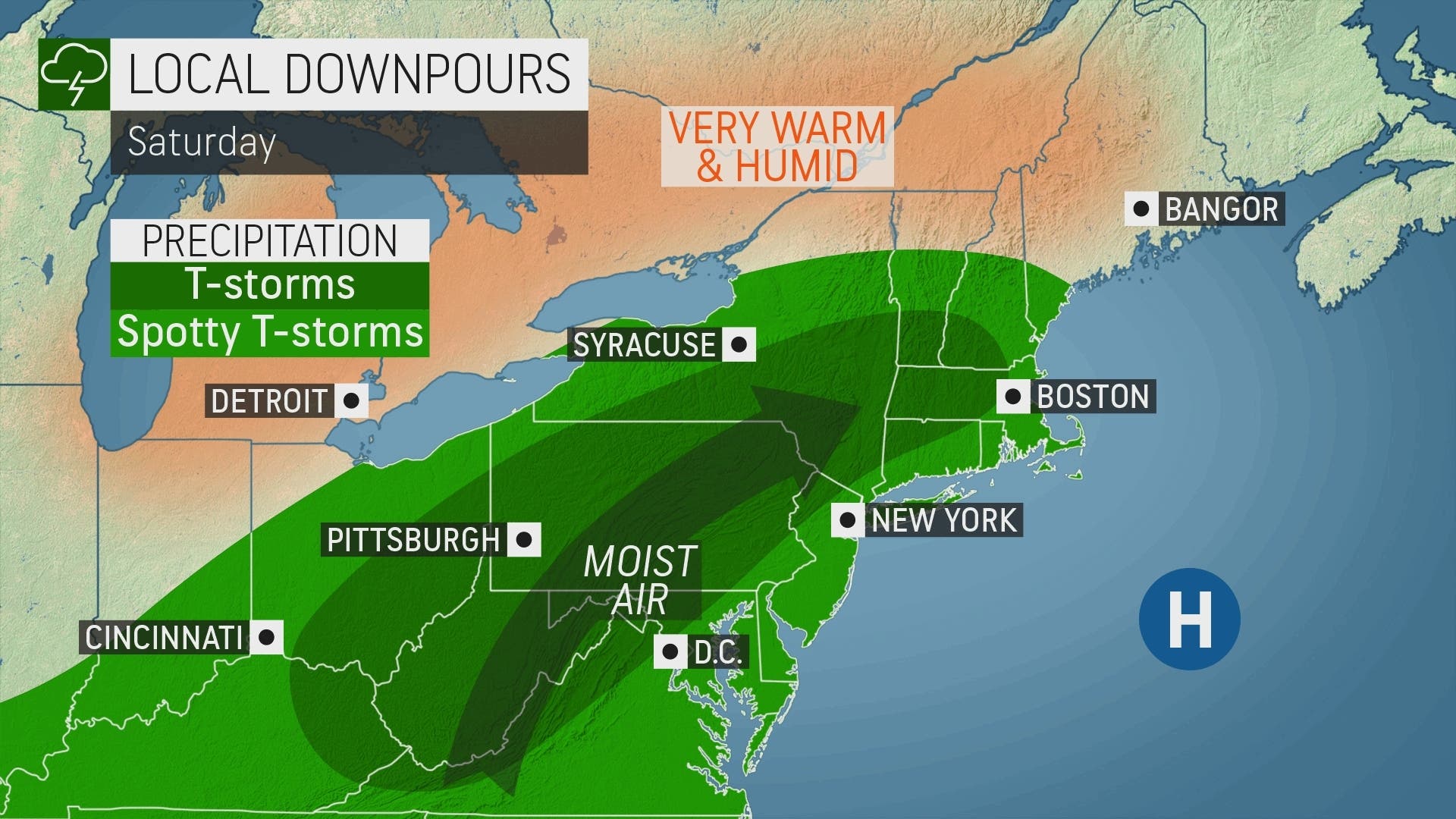
On Saturday temps will inch down and there will be another chance for rain.
Into next week, temps will be in the low 90s. Will it feel balmy? Let us know.
Here's the forecast from the National Weather Service, based on Rockland County:
- Thursday - Sunny. A slight chance of showers and thunderstorms this afternoon. Hot with highs in the mid 90s. Southwest winds 5 to 10 mph. Gusts up to 20 mph this afternoon. Chance of rain 20 percent. Heat index values up to 103.
- Thursday night - Partly cloudy with a chance of showers and thunderstorms in the evening, then mostly cloudy with a slight chance of showers and thunderstorms after midnight. Humid with lows in the mid 70s. South winds 5 to 10 mph with gusts up to 20 mph, becoming west after midnight. Chance of rain 40 percent.
- Friday - Partly sunny. A slight chance of showers and thunderstorms in the morning, then a chance of showers and thunderstorms in the afternoon. Humid with highs around 90. Southwest winds around 5 mph. Chance of rain 50 percent. Heat index values in the upper 90s.
- Friday Night - Mostly cloudy. Showers and thunderstorms likely, mainly in the evening. Humid with lows in the lower 70s. Southwest winds around 5 mph. Chance of rain 70 percent.
- Saturday - Partly sunny with a chance of showers and thunderstorms. Humid with highs in the upper 80s. Southwest winds around 5 mph. Chance of rain 50 percent. Heat index values in the mid 90s.
- Saturday Night - Partly cloudy. A chance of showers and thunderstorms in the evening. Lows in the lower 70s. Chance of rain 50 percent.
- Sunday - Mostly sunny. Highs in the lower 90s. Heat index values up to 100.
- Sunday Night - Partly cloudy. Lows in the lower 70s.
- Monday - Partly sunny. A chance of showers and thunderstorms in the afternoon. Highs in the lower 90s. Chance of rain 40 percent. Heat index values up to 100.
Get more local news delivered straight to your inbox. Sign up for free Patch newsletters and alerts.


