Weather
Hour-by-hour Look At Storms Drenching The Hudson Valley
Here are the latest details about the next 48 hours.

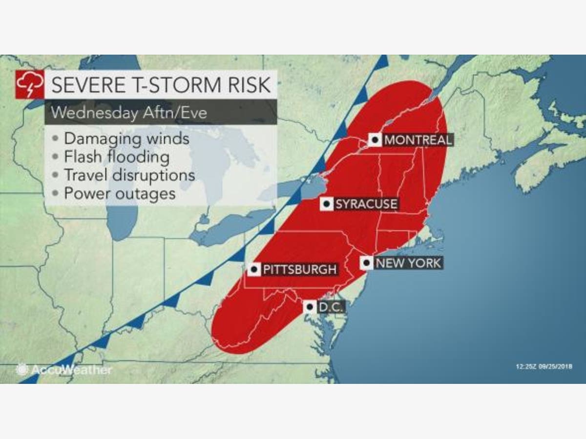
HUDSON VALLEY, NY — We're not going to get a real break in the rain until Thursday morning. It will moderate overnight, but then is expected to intensify again Wednesday afternoon, when severe, rapidly moving thunderstorms are expected.
The main threats from Wednesday’s storms will be flooding downpours and damaging winds. Plus, isolated tornadoes cannot be ruled out, AccuWeather meteorologists warned.
"So make sure you have the rain gear handy," said Bill Potter and Alex Marra from Hudson Valley Weather.
Find out what's happening in Peekskill-Cortlandtfor free with the latest updates from Patch.
There are hazardous weather outlooks out for most of the Hudson Valley. The National Weather Service says:
Thunderstorms are possible Wednesday afternoon into Wednesday evening along or ahead of a cold front, some of which may produce strong to damaging wind gusts. The Storm Prediction Center has placed all of eastern New York and adjacent western New England within a Slight Risk for severe thunderstorms for Wednesday.
Additional showers and thunderstorms may also cause localized urban and low lying flooding on Wednesday as well, especially for any locations that experience heavy rain today.
Here's the hour-by-hour forecast from the NWS:
Find out what's happening in Peekskill-Cortlandtfor free with the latest updates from Patch.
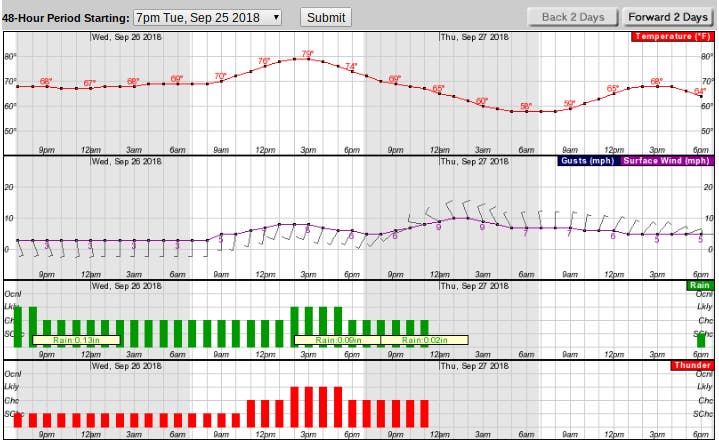
Chart via National Weather Service
Map via AccuWeather.com
Get more local news delivered straight to your inbox. Sign up for free Patch newsletters and alerts.