Weather
Nor'easter Batters LI: 'Still In Heart Of It' As Fierce Winds, Soaking Rains, Flooding Continue Overnight
A powerful nor'easter will continue to pummel LI Saturday night with soaking rain, up to 65 mph winds and severe coastal flooding: NWS


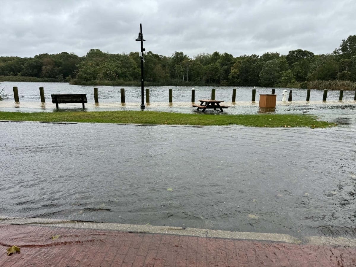
LONG ISLAND, NY — As the first nor'easter continues to pummel Long Island Saturday, residents can expect to see the worst of the impacts through evening hours and into Sunday, the National Weather Service said.
"We're continuing to be in the midst of this storm," Nelson Vaz, meteorologist with the National Weather Service office in Upton told Patch Saturday.
A coastal flood warning remains in effect across Long Island until 6 p.m. Sunday. A high wind warning, with gusts of up to 65 miles per hour, is in effect across Long Island until noon Sunday, the NWS said.
Find out what's happening in Riverheadfor free with the latest updates from Patch.
The coastal storm is continuing to drift toward the Long Island area from off over the ocean; currently, the storm is about 200 miles off the New Jersey coast and is "slowly curving in toward the New York harbor," he said.
With that, Vaz said, Long Island — and especially eastern Long Island — saw increased rain Saturday night and winds of 20 to 25 miles per hour, with wind gusts of up to 55 mph and isolated gusts of up to 60 mph.
Find out what's happening in Riverheadfor free with the latest updates from Patch.
That fierce wind and heavy rain is expected to continue through Sunday morning, with bands of heavy rain leading to flash flooding and severe flooding, especially in areas of poor drainage, Vaz said.
That flooding that will continue through Sunday night; however, the wind threat is slated to die down Sunday afternoon, decreasing to below 40 mph gusts, Vaz said.
Looking ahead into the next 24 hours, Vaz said Long Island still has a couple more cycles of coastal flooding to contend with.
"We are generally looking at widespread moderate coastal flooding across Long Island through tonight's and Sunday morning’s high tide," he said.
Southern Nassau County, as well as southwestern and south-central Long Island and areas near the Twin Forks will also see "localized, major coastal flooding Saturday night and with the morning's high tide," Vaz said. "Once we get past tomorrow morning and into the early afternoon, depending on where you are, the coastal flooding should become minor. We just have to get through the next 24 hours. We're still in the heart of this."
Residents, Vaz said, should stay inside if possible, with strong winds, downed trees, and power outages making it "dangerous to venture out," especially in terms of potentially flooded roads near the coast, which residents should avoid.
When all is said and done, Vaz said an additional 2 to 4 inches of rain is expected to fall through Sunday night; a total of 4 to 6 inches in total is slated to have fallen across Long Island during the nor'easter.
"It's a good, soaking rain. The good thing is that it's been over a long duration, although we could still seem some localized flash flooding as we go through tonight and Sunday," Vaz said.
According to Bill Goodman, meteorologist with the NWS office in Upton, the greatest hazards posed include coastal flooding with the upcoming high tides, which will be "a big problem for some spots," he said.
Area where the most serious flooding are expected include the Great South Bay, areas in western Suffolk and Nassau County, and the west end of the Peconic Bay in Riverhead, where the winds are funneling into the bay and water is "piling up," he said.
"These are areas where more significant coastal flooding usually takes place and where we can expect to see major flooding — at the big problem spots," Goodman said.
Beaches on the South Fork, heading toward Montauk, including Napeague, can also expect major flooding, he said.
Significant beach erosion on Dune Road is also a concern, as well as washovers on the Fire Island barrier islands, he said.
A coastal flood warning is in effect for all shores of Long Island through daytime Sunday, during multiple high tide cycles and bringing moderate to major flooding, Goodman said.
As for wind, so far, there has been a report of winds gusting up to 61 miles per hour in Farmingdale, Goodman said; gusts of 45 to 55 mph, and up to 60 mph, are expected through Sunday, he said, with the highest winds expected on the North Shore and East End of Long Island.
Get more local news delivered straight to your inbox. Sign up for free Patch newsletters and alerts.