
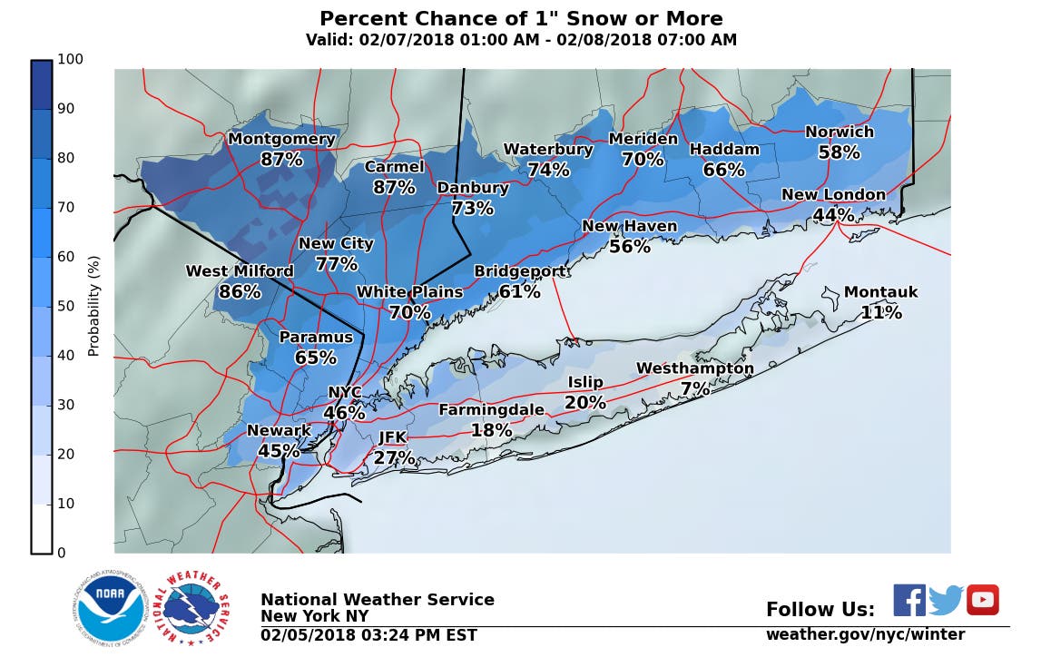
Less than an inch of snow is expected to fall on Long Island Wednesday, but the timing of the snow may cause some issues during the morning commute.
Snow will likely begin falling by 6 a.m., the National Weather Service says. Warming temperatures should turn that snow into rain by around 11 a.m.
The NWS map below shows the odds for more than an inch of snow accumulation on various parts of the island.
Find out what's happening in Sachemfor free with the latest updates from Patch.
The full forecast:
Tuesday- A slight chance of snow showers between 9am and noon. Cloudy, then gradually becoming mostly sunny, with a high near 37. Wind chill values between 20 and 30. Light southwest wind increasing to 5 to 9 mph in the morning. Chance of precipitation is 20%.
Find out what's happening in Sachemfor free with the latest updates from Patch.
Tuesday Night- Partly cloudy, with a low around 28. Wind chill values between 20 and 25. Light and variable wind becoming northeast 5 to 8 mph after midnight.
Wednesday- Snow likely before 11am, then rain. High near 44. Wind chill values between 20 and 30. East wind 7 to 14 mph becoming southeast in the afternoon. Chance of precipitation is 90%. New snow accumulation of less than a half inch possible.
Wednesday Night- Rain before 3am, then a chance of snow and freezing rain. Low around 29. South wind 13 to 16 mph becoming northwest after midnight. Chance of precipitation is 90%. Little or no ice accumulation expected. New snow accumulation of less than a half inch possible.
Thursday- Mostly cloudy, then gradually becoming sunny, with a high near 34.
Thursday Night- Mostly clear, with a low around 21.
Friday- Partly sunny, with a high near 34.
Get more local news delivered straight to your inbox. Sign up for free Patch newsletters and alerts.