The Winter Weather Advisory issued by the National Weather Service for Putnam County says that the periods of snow, sleet or freezing rain will cause travel difficulties.
“Be prepared for slippery roads and limited visibilities and use caution while driving,” the NWS said.
The alert is in force until 6 a.m. tomorrow, though the probability of precipitation drops sharply after 1 a.m.
Find out what's happening in Southeast-Brewsterfor free with the latest updates from Patch.
Icy roads overnight with the prospect of more to come caused school officials in Brewster to close for the day. The plethora of snow days will mean modifications to school calendars this spring.
Here’s the hour-by-hour forecast from weather.com:
Find out what's happening in Southeast-Brewsterfor free with the latest updates from Patch.
10AM-noon: cloudy, temperatures around 17 degrees, winds out of the north-northeast at 11 miles per hour
12-1PM: snow, temperature up a notch, winds steady.
1-4PM: light snow, highest temperatures of the day, NNE winds 12 mph.
4-7PM: snow showers, temperature 21 degrees, NNE winds 10 mph
7PM-9PM: light snow, temperature 20 degrees, NNE winds 10 mph
10PM-2AM: snow showers, temperature 21, NNE winds 10 mph
3AM-7AM: cloudy, temperatures 21, NNE winds 10 mph
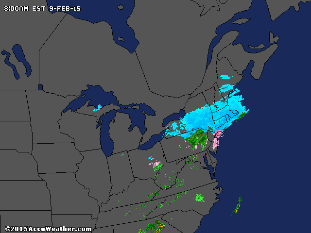
IMAGE: accuweather.com
Get more local news delivered straight to your inbox. Sign up for free Patch newsletters and alerts.