Weather
Latest Details On Upcoming Snow Chances: Brewster's Weather
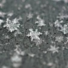
We give you the latest details on when we may see snow around Southeast. New info has emerged about a potential weekend snowstorm.

SOUTHEAST, NY — Disruptive snowstorms are expected to come sweeping through from the west over the next week, but will they affect the Hudson Valley?
If you have weekend plans there is some good news for you. A forecasted snowstorm for this weekend appears as of right now to be a miss for the Hudson Valley — our chance of snow is only about 30 percent.
However, snow appears a possibility for both Friday and next Tuesday as well.
Find out what's happening in Southeast-Brewsterfor free with the latest updates from Patch.
AccuWeather meteorologists called the series of snowstorms "winter's revenge."
“The reason for the upcoming snow threats is that the boundary between very cold air to the north and very mild air to the south will be over the Midwest and Northeast,” said AccuWeather Chief Meteorologist Elliot Abrams, “and the storms often track along that boundary.”
Find out what's happening in Southeast-Brewsterfor free with the latest updates from Patch.
The first chance for snow would begin close to midnight Thursday and continue into Friday afternoon, according to the National Weather Service. No accumulation estimates have been made as of yet. Forecast models suggest it might pass us to the south.
As for the weekend storm, forecast models suggest it won’t make it to the Hudson Valley either, though we could be affected by frigid air on its northern edge.
Tuesday is too far out to discuss.
The National Weather Service's five-day forecast for Putnam County:
Today
Periods of light rain. Highs in the lower 50s. Southeast winds 5 to 10 mph. Chance of rain 80 percent.
Tonight
Periods of rain. Lows in the mid 40s. South winds 5 to 10 mph. Gusts up to 20 mph after midnight. Chance of rain 80 percent.
Wednesday
Mostly cloudy with periods of rain in the morning... Then partly sunny with a chance of rain in the afternoon. Highs in the mid 50s. West winds 10 to 15 mph. Chance of rain 80 percent.
Wednesday Night
Partly cloudy in the evening...then clearing. Lows in the lower 30s. West winds 10 to 15 mph.
Thursday
Sunny. Highs in the mid 40s. West winds 10 to 15 mph with gusts up to 30 mph.
Thursday Night
Partly cloudy in the evening...then mostly cloudy with a chance of snow after midnight. Lows in the upper 20s. Chance of snow 30 percent.
Friday
Mostly cloudy in the morning...then becoming partly sunny. A chance of snow. Highs in the upper 30s. Chance of snow 30 percent.
Friday Night
Partly cloudy. Cold with lows around 15.
Saturday
Mostly sunny. Cold with highs in the mid 20s. Wind chill values as low as zero.
Saturday Night
Mostly cloudy. A chance of snow after midnight. Cold with lows 10 to 15. Chance of snow 30 percent.
Get more local news delivered straight to your inbox. Sign up for free Patch newsletters and alerts.


