Weather
‘Plowable Snow’ for Brewster Becoming More Likely This Week
A very stormy midweek, as we'll see unsettled weather Tuesday, Wednesday and likely Thursday now. Here are the latest details.

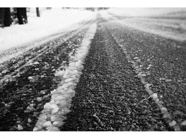
BREWSTER, NY — The big new news this morning is that it now looks increasingly likely that the Hudson Valley could receive some “plowable snow” this week. Plus, we’re dealing with an ice and rain storm in part of the region on Tuesday and early Wednesday (though just plain rain at the coast).
"Our attention turns to Tuesday AM, a low pressure system cutting up into the Great Lakes," said Bill Potter of Hudson Valley Weather. "Just like they have so many times this winter, our region will be on the warm side of the storm."
That means that the early Tuesday morning commute could be affected in the northern part of the region. The National Weather Service has issued a Winter Weather Advisory for Greene, Columbia, Delaware, Sullivan, Ulster and Dutchess and a freezing rain advisory for Orange County.
Find out what's happening in Southeast-Brewsterfor free with the latest updates from Patch.
But it'll turn to plain rain for everyone.
Then there's Thursday, when a low-pressure system might bring up to six inches of snow, the National Weather Service says in its Hazardous Weather Outlook for Putnam, Rockland, Westchester,
Find out what's happening in Southeast-Brewsterfor free with the latest updates from Patch.
But the forecast is very volatile and meteorologists are keeping a close eye on the weather pattern.
"Some guidance brings this wave far enough north to spread a plowable snowfall into our region, others keep the wave further south with little or no impact," Potter said.
Here's the National Weather Service's work-week forecast for Putnam County:
Today
Mostly sunny. Highs in the mid 30s. West winds 5 to 10 mph. Gusts up to 20 mph this afternoon.
Tonight
Mostly cloudy. A chance of freezing rain after midnight. Lows in the lower 30s. Southeast winds around 5 mph. Chance of precipitation 50 percent.
Tuesday
Rain. Freezing rain likely in the morning. Ice accumulation around a trace. Highs in the lower 40s. Southeast winds around 5 mph. Chance of precipitation 90 percent.
Tuesday Night
Light rain. Lows around 40. Southeast winds around 5 mph...becoming south after midnight. Chance of rain 80 percent.
Wednesday
Partly sunny. A chance of light rain in the morning. Highs in the lower 50s. Temperature falling into the mid 40s in the afternoon. West winds around 10 mph. Chance of rain 30 percent.
Wednesday Night
Mostly cloudy with a chance of snow. A chance of rain in the evening. Cooler with lows in the mid 20s. Chance of precipitation 40 percent.
Thursday
Partly sunny. A chance of snow in the morning. Much cooler with highs around 30. Chance of snow 40 percent.
Thursday Night
Partly cloudy. Lows 15 to 20.
Friday
Mostly sunny. Highs in the lower 30s.
Friday Night
Mostly cloudy. A chance of light snow after midnight. Lows in the mid 20s. Chance of snow 30 percent.
Get more local news delivered straight to your inbox. Sign up for free Patch newsletters and alerts.


