Home & Garden
WEATHER UPDATE: 'Potentially Treacherous' Tuesday Evening Commute
Snow and ice could also make tomorrow morning's commute difficult and significant snow is possible Thursday in Brewster.


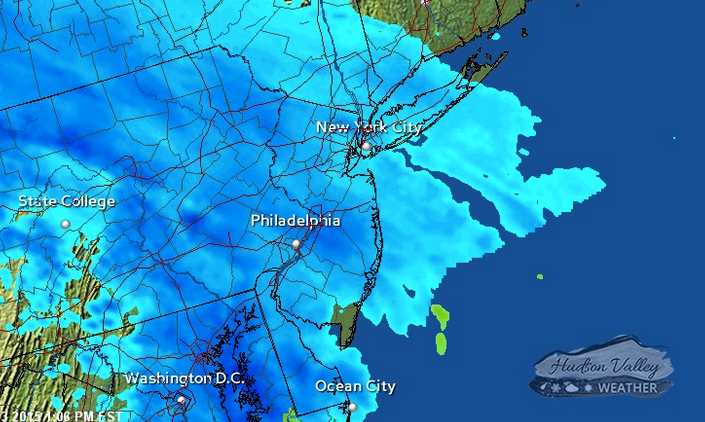
You might want to sneak out of work a little early today, just to be on the safe side.
And while you’re at it, you might want to call out in advance for Thursday, where up to six inches of snow is possible late Wednesday into Thursday afternoon.
Yes, more snow is forecast for tonight’s commute home from work, as snow is expected to begin falling around 4 p.m. and be relatively heavy in intensity, before it changes to ice late Tuesday, and then some light rain showers on Wednesday.
Find out what's happening in Southeast-Brewsterfor free with the latest updates from Patch.
“Snow breaks out from west to east, just in time to make a mess of the Tuesday evening commute,” says Bill Potter from Hudson Valley Weather. “ You’ll want to allow extra travel time for your PM commute, because the snow should be falling quite steadily at that point. An inch or two is possible by the time the sun sets.”
The National Weather Service has issued a Winter Weather Advisory for Putnam County:
Find out what's happening in Southeast-Brewsterfor free with the latest updates from Patch.
Here’s the NWS forecast for Brewster:
- This Afternoon-Snow, mainly after 4pm. High near 30. Wind chill values between 20 and 25. South wind around 7 mph. Chance of precipitation is 80%. Total daytime snow accumulation of 1 to 2 inches possible.
- Tonight-Snow, freezing rain, and sleet before midnight, then rain and sleet between midnight and 2am, then rain, possibly mixed with freezing rain after 2am. Temperature rising to around 34 by 3am. Wind chill values between 20 and 25. South wind 6 to 8 mph becoming southwest after midnight. Chance of precipitation is 100%. New ice accumulation of less than a 0.1 of an inch possible. New snow and sleet accumulation of 1 to 2 inches possible.
- Wednesday-Rain likely, possibly mixed with freezing rain before 9am, then a chance of rain. Cloudy, with a high near 40. Wind chill values between 30 and 35. West wind around 7 mph. Chance of precipitation is 70%. Little or no ice accumulation expected.
- Wednesday Night-Rain likely before 9pm, then snow likely. Cloudy, with a low around 23. Calm wind becoming north around 6 mph after midnight. Chance of precipitation is 70%. New snow accumulation of 1 to 3 inches possible.
- Thursday-Snow likely, mainly before noon. Cloudy, with a high near 25. Northwest wind around 8 mph. Chance of precipitation is 70%. New snow accumulation of 1 to 3 inches possible.
- Thursday Night-Partly cloudy, with a low around 5.
MAP: Hudson Valley Weather
Get more local news delivered straight to your inbox. Sign up for free Patch newsletters and alerts.