Weather
Weekend Snow Chance in Brewster Diminishing: UPDATE
Enjoy the warmer temperatures in Southeast Thursday, because colder air will affect our three-day weekend.

BREWSTER, NY — If you were looking forward to more snow this weekend in the Hudson Valley, you will be disappointed.
And enjoy the temperatures for Thursday, because we won’t see temps in the 50s long as colder air comes into the region.
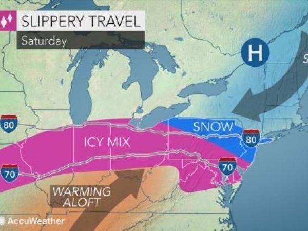
Bill Potter of Hudson Valley Weather said that cold air that will be ushered in after the rains of Thursday move out is what will prevent the previously forecast snow from reaching the Hudson Valley.
Find out what's happening in Southeast-Brewsterfor free with the latest updates from Patch.
“Originally, the snow looked much heavier… and further north than it is currently projecting, putting the Hudson Valley in the cross hairs,” he said. “Now, that boundary is projected near Washington, DC, which puts the snow threat in southern PA and southern NJ for the most part.”
That doesn’t mean we can completely rule out light snow showers. But, as Potter said, the potential for a snowstorm on Saturday seems to have diminished, leaving us with the prospect of a three-day weekend with fairly decent weather.
Find out what's happening in Southeast-Brewsterfor free with the latest updates from Patch.
Here is the updated forecast for Putnam County from the National Weather Service:
This Afternoon
Mostly cloudy with a 50 percent chance of rain. Highs in the upper 50s. Southwest winds around 10 mph with gusts up to 20 mph.
Tonight
Mostly cloudy. A slight chance of showers in the evening. Lows in the upper 30s. Southwest winds around 10 mph with gusts up to 20 mph...becoming northwest after midnight. Chance of rain 20 percent.
Friday
Mostly sunny. Highs around 40. Northwest winds 10 to 15 mph with gusts up to 30 mph.
Friday Night
Mostly clear in the evening...then becoming mostly cloudy. Much cooler with lows around 15. North winds 5 to 10 mph. Gusts up to 20 mph in the evening.
Saturday
Cloudy. A chance of light snow...mainly in the afternoon. Highs in the upper 20s. Northeast winds around 5 mph... Becoming south around 5 mph in the afternoon. Chance of snow 40 percent.
Saturday Night
Mostly cloudy. A chance of light snow in the evening. Lows around 20. Chance of snow 40 percent.
Sunday
Sunny. Highs in the mid 30s.
Sunday Night
Mostly clear. Lows around 20.
Martin Luther King Jr Day
Mostly sunny. Highs in the mid 30s.
Monday Night
Mostly cloudy. A chance of rain and freezing rain after midnight. Lows in the lower 30s. Chance of precipitation 30 percent.
Map: AccuWeather.com
Get more local news delivered straight to your inbox. Sign up for free Patch newsletters and alerts.


