Home & Garden
Back to School, Work Weather: Hazardous Weather Outlook Issued
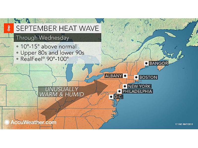
Tuesday and Wednesday will be hot, but rain is finally on the way later in the week. It may be heavy at times, with possible flooding.

The National Weather Service issued a Hazardous Weather Outlook for Westchester County for showers and thunderstorms beginning late Wednesday night.
Rains will likely be heavy at times and will last through Thursday night.
“There is a chance for flash flooding during this timeframe,” writes the NWS.
Find out what's happening in Tarrytown-Sleepy Hollowfor free with the latest updates from Patch.
Before the rains, today will be hot with highs in the low 90s. Lows tonight will not dip below 70.
Wednesday will start off a little foggy, but then will be mostly sunny with highs in the mid 80s.
Find out what's happening in Tarrytown-Sleepy Hollowfor free with the latest updates from Patch.
“Summer is going to dig its heels in across the Northeast for much of the week,” said AccuWeather Meteorologist Brian Thompson, “as it will feel more like late July or early August rather than September.”
During Thursday’s precipitation, highs will be in the low 80s and lows in the mid 60s.
On Friday, a chance of rain returns before noon, with highs in the low 80s. Lows will be in the low 60s.
Click here to view your hour-by-hour forecast from Tarrytown-Sleepy Hollow Patch.
Patch Editor Lanning Taliaferro contributed to this report.
Map via AccuWeather.com
Get more local news delivered straight to your inbox. Sign up for free Patch newsletters and alerts.