Weather
Hurricane Matthew Impact to Hudson Valley Shifts Overnight
Hurricane Matthew's potential impact to the Hudson Valley shifted overnight as forecasters now predict the massive storm will veer east.

For about five minutes yesterday the alarm was sounded in the Hudson Valley regarding Hurricane Matthew, as suddenly the "cone of uncertainty" included our area for the first time. And, in less than 24 hours, it’s looking like the weekend may be largely sunny and Matthew could be headed out to sea and offer very little, if any, impact to New York's weather.
The National Weather Service, in its updated forecast for Orange, Putnam, Westchester and Rockland counties Wednesday morning, still has a "Hazardous Weather Outlook" in effect, but it's admitting the chances of the state being impacted by Matthew are declining.
“While trends in the forecast point to a lower probability of the area being impacted by Hurricane Matthew, it remains prudent to stay on top of the latest forecast,” the National Weather Service says of the Hudson Valley.
Find out what's happening in Tarrytown-Sleepy Hollowfor free with the latest updates from Patch.
While the National Weather Service is remaining cautious, Bill Potter of Hudson Valley Weather said his tracking has the hurricane staying away from our region.
"So far away, in fact, that our area may see little (if any) rainfall over the weekend," he said. "The frontal boundary will push through overnight Friday into Saturday… and if it doesn’t draw some of Matthew’s moisture up north… it will have very little rain associated with it."
Find out what's happening in Tarrytown-Sleepy Hollowfor free with the latest updates from Patch.
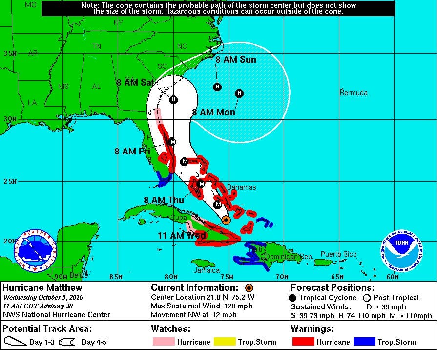
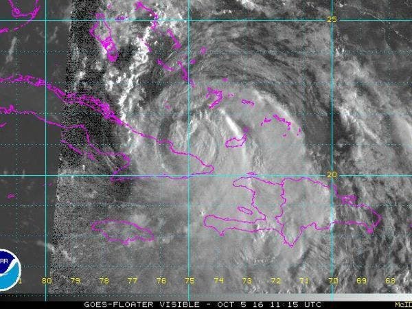
Hurricane Matthew weakened somewhat after its Tuesday run-ins with Haiti and Cuba, but it still remained a powerful Category 3 storm Wednesday morning. Packing maximum sustained winds of 115 mph, the storm is on a path that will bring it to the Bahamas and possibly Florida over the next day, according to the National Hurricane Center.
- See also: Sheriff Warns of ‘Creepy Clown’ Hoaxes | Bronx Man Sells Heroin in Southeast | County Locations Show Up in Movie Thriller
- Passing a Kidney Stone—Could Playland's Roller Coaster Help?: Study
Matthew is expected to make a northwest turn on Wednesday as it moves across the Bahamas through Thursday. "Hurricane conditions are expected to first reach the hurricane warning area in Florida by late Thursday and will spread northward Thursday night and Friday," forecasters wrote in the 11 a.m. update.
As of Wednesday morning, forecasters anticipated Matthew’s strength would increase again over the next few days. Hurricane-force winds were extending out from Matthew by 40 miles. Tropical storm-force winds extended out up to 160 miles.
Additional reporting by Sherri Lonon
Graphics courtesy of NOAA
Get more local news delivered straight to your inbox. Sign up for free Patch newsletters and alerts.