Weather
Hurricane Dorian: Here's What NC Can Expect Over Labor Day
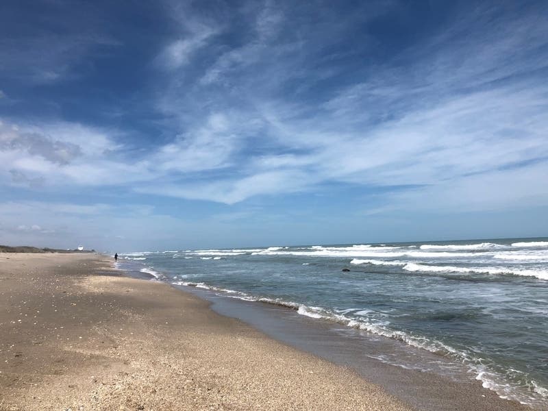
Tropical Storm Erin has heightened the risk of rip currents along North Carolina's coast ahead of Labor Day weekend.

CHARLOTTE, NC — North Carolina beaches will feel the impacts of two tropical storms brewing in the Atlantic going into Labor Day weekend, according to forecasters.
As of 11 a.m. Aug. 28, Tropical Storm Erin remained about 300 miles off the coast of Wilmington, moving north-northwest at about 13 mph, with sustained winds of about 35 mph, according to the National Weather Service.
Further south, Tropical Storm Dorian strengthened as it closed in on Puerto Rico and the Virgin Islands Wednesday. The Associated Press reported late Wednesday morning that Dorian could become a Category 3 with winds from 111 to 129 mph, before hitting the United States. In Florida, Gov. Ron DeSantis said all residents on the East Coast should prepare for possible impacts and at least one Florida county opened sandbag filling stations amid predictions that the storm would reach hurricane strength.
Find out what's happening in Charlottefor free with the latest updates from Patch.
While forecasters remain uncertain about where Dorian will strike along the southeastern mainland over the weekend, the storm is expected to strengthen over warm ocean waters before it reaches the Florida and Georgia coastline, National Hurricane Center director Ken Graham said Wednesday.
“More time over these warm waters, which basically means you can get a stronger storm,” Graham said. “Anywhere from South Carolina — the Carolinas, down to Georgia and almost the entire coastline of Florida — you need to have your plans ready,” Graham said.
Find out what's happening in Charlottefor free with the latest updates from Patch.
Patch is tracking every move of Tropical Storm Dorian. Get all the updates on the storm by subscribing to Patch's free breaking news alerts and daily newsletters.
“Right now we’re looking at fair game for the center being in any one of those areas,” he said.
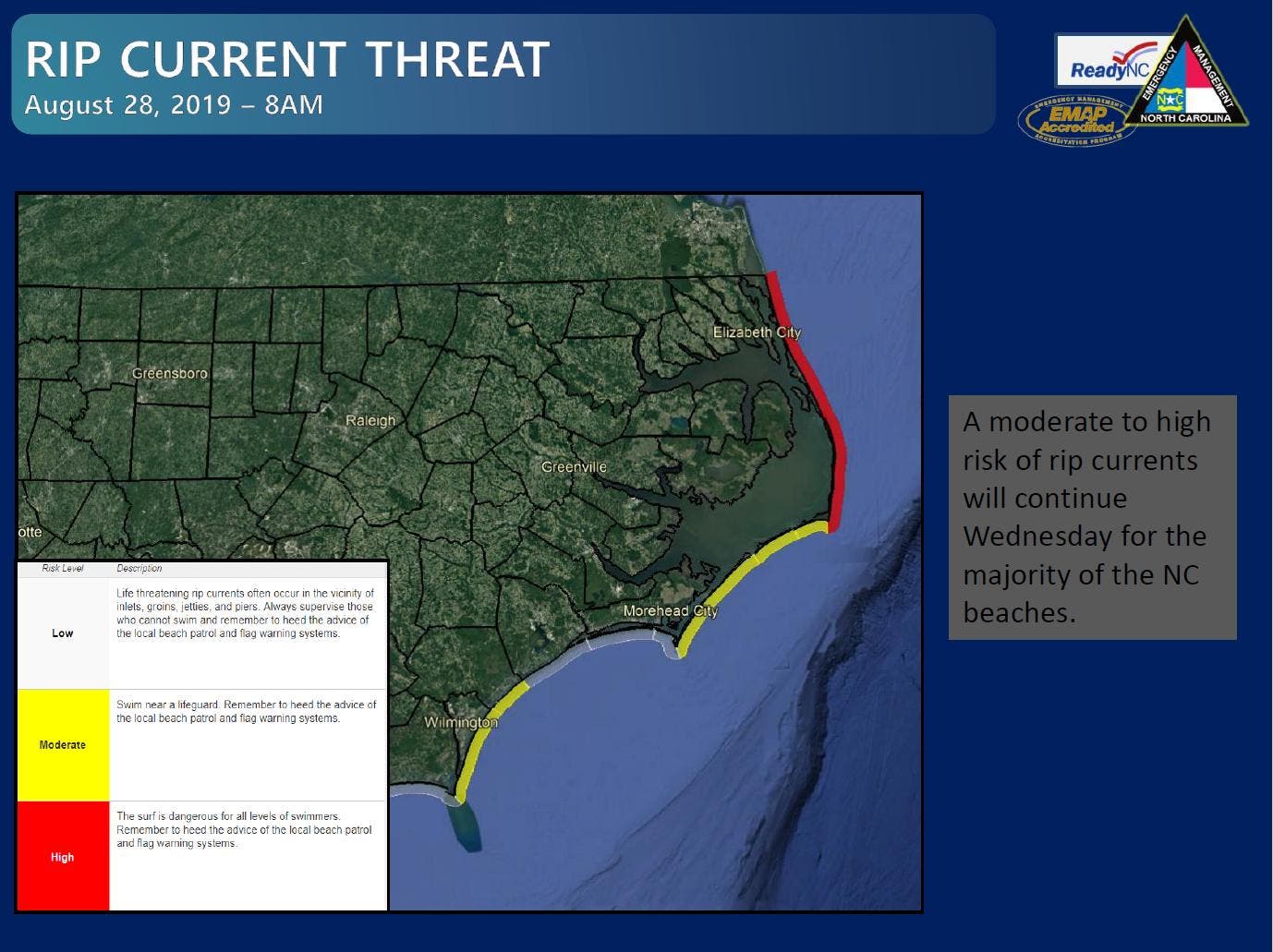
In North Carolina, emergency officials issued rip current warnings along the state’s coastline going into the Labor Day weekend.
“A moderate to high risk of rip currents remains through Wednesday evening,” North Carolina Emergency Management said of Tropical Storm Erin Wednesday morning. “Enhanced rip currents will likely develop into the weekend associated with swells from Dorian.
Those rip currents from Erin are expected to last through Thursday and could continue into the weekend if Tropical Storm Dorian also decides to take a turn toward the North, the NWS said.
"Newly formed Tropical Storm Erin will remain well off the East Coast as it tracks north and northeast through Friday. No impacts are expected locally other than elevated seas and enhanced rip currents along the coast," the National Weather Service office in Wakefield, Virginia said Wednesday morning.
RELATED: 2019 Hurricane Season: How Many Major Storms Are Forecasted
The beach hazards statement applies to beaches in Maryland, Virginia and the Outer Banks of North Carolina. Breaking waves of 3 to 5 feet will result in rough surf conditions and a high risk of rip currents.
A Beach Hazards Statement is issued when threats such as rip currents, longshore currents, sneaker waves and other hazards create life-threatening conditions in the surf zone. Caution
should be used when in or near the water, the weather service said.
Here are Erin's potential impacted areas:
.jpg)
Rip currents are powerful channels of water flowing quickly away from shore, which occur most often at low spots or breaks in the sandbar and in the vicinity of structures such as jetties and
piers. Heed the advice of lifeguards, beach patrol flags and signs.
If you become caught in a rip current you should relax and float, the NWS says. Don't swim against the current. If able, swim in a direction following the shoreline. If unable to escape, face the shore and call or wave for help.
SEE ALSO: Dorian Could Hit FL As Cat 2 Hurricane; Closes In On Puerto Rico
Here's the latest National Weather Service forecast for the piedmont of North Carolina:
Wednesday (Aug. 28)
A slight chance of showers, then a chance of showers and thunderstorms after 2pm. Partly sunny, with a high near 85. Calm wind becoming northwest around 6 mph in the afternoon. Chance of precipitation is 30%.
Tonight
Mostly clear, with a low around 65. North wind 6 to 8 mph.
Thursday (Aug. 29)
Sunny, with a high near 85. North northeast wind 5 to 9 mph.
Thursday Night
Mostly clear, with a low around 64. Light north wind.
Friday (Aug. 30)
Sunny, with a high near 88. Northeast wind 3 to 5 mph.
Friday Night
Mostly clear, with a low around 65.
Saturday (Aug. 31)
Sunny, with a high near 88.
Saturday Night
Mostly clear, with a low around 67.
Sunday (Sept. 1)
A 30 percent chance of showers after 10am. Mostly sunny, with a high near 84.
Sunday Night
A 30 percent chance of showers. Mostly cloudy, with a low around 68.
Labor Day (Sept. 2)
A 40 percent chance of showers. Partly sunny, with a high near 84.
Monday Night
A 30 percent chance of rain. Partly cloudy, with a low around 68.
Tuesday (Sept. 3)
A 30 percent chance of rain. Partly sunny, with a high near 85.
WATCH: Ken Graham, director of National Hurricane Center
Patch Editor Deb Belt, Associated Press contributed.
Get more local news delivered straight to your inbox. Sign up for free Patch newsletters and alerts.