Weather
Portland Weather Forecast: No Snow For Portland and the Flood Watch Is Canceled
The snow storm, as had always been a possibility, headed north, hitting Seattle. The rain in Portland causes flooding and landslides.


The snowpocalypse that had been possible for the Portland metro region decided to go north and visit Seattle. Portland and the surrounding communities got rain. Except, of course, for the mountains to the east and west. But, they are mountains.
The National Weather Service had been upfront since the beginning: there was a worst case scenario, a most likely scenario, and a best case scenario. The worst case had Portland getting as much as as six inches or more of snow. The best case said no snow at all.
And that's what happened. A lot of rain. No snow.
Find out what's happening in Portlandfor free with the latest updates from Patch.
It is, of course, different outside the metro area. The weather service reports six inches in Vernonia. Five inches in Longview.
All that rain- and, actually - all the rain we already have now is raising the possibility of flooding through the area. The National Weather Service said the rain is heavy enough that there was flood watch in effect most of Sunday until Monday morning for much of northwest Oregon and southwest Washington.
Find out what's happening in Portlandfor free with the latest updates from Patch.
PATCH CONTEST: WIN FREE BOOKS AND BEER!
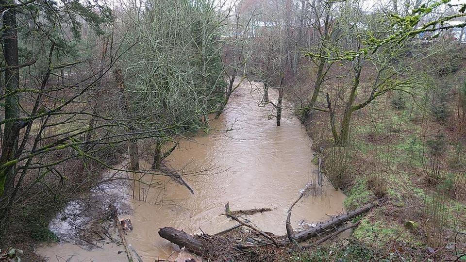
Creeks and rivers ran high. There was also street flooding and landslides. One landslide caused a lane of U.S. 26 by the Zoo. One lane of Southbound OR 43 at the Sellwood Bridge was also closed because of a landslide.

By early afternoon, Johnson Creek in Southeast Portland was close to cresting near flood stage. Beaver Creek was also running high.
Forecasters also said there would be the possibility of urban flooding. By early afternoon, it was clear they were right.
Southeast Pipeine road between Altman Road and Southeast 302nd Avenue was closed due to high water.

The snow possibility led to a winter weather advisory being in effect until Monday morning.
With snow and freezing temperatures a possibility, Multnomah County opened its warming centers on Sunday.
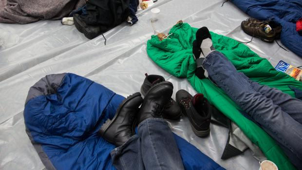
The county says that as severe weather persists staff at A Home For Everyone will continue to monitor conditions and ensure sufficient warming center capacity.
Year-round winter shelters remain open. Anyone seeking shelter in Multnomah County should dial 211 or visit 211info.org/emergency/#multnomah to identify the closest available shelter and arrange for transportation. Callers may need to be patient if call volumes are higher than usual. Families with children seeking shelter should call 211 to be directed to a shelter that can accommodate children.
While the forecasters are saying the storm has shifted north, it has not shifted enough to miss the Portland metro area. Though, they say, it has shifted enough that the area won't get as much snow as originally feared.
Instead of waking up to as much as a foot of snow, people in the metro area should only see between one and four inches. The higher your elevation, the more snow you will see.
Forecasters say the the rain will get heavier as the morning goes on before shifting to snow in the afternoon.
The weather service says it will be enough to likely make the commute a bit of a chore with the snow on top of the rain making roads slick.
"Use caution while driving," they say.
And more rain is expected throughout the week.
Graphics and photos of Beaver Creek via National Weather Service-Portland
Photos of SE Pipeline Road and the warming center courtesy Multnomah County
Get more local news delivered straight to your inbox. Sign up for free Patch newsletters and alerts.