Weather
Flash Flood Warning Issued In Philly Region
Heavy rainfall could continue for hours, putting the region at risk of flooding.


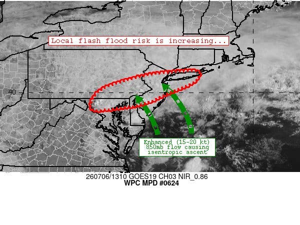
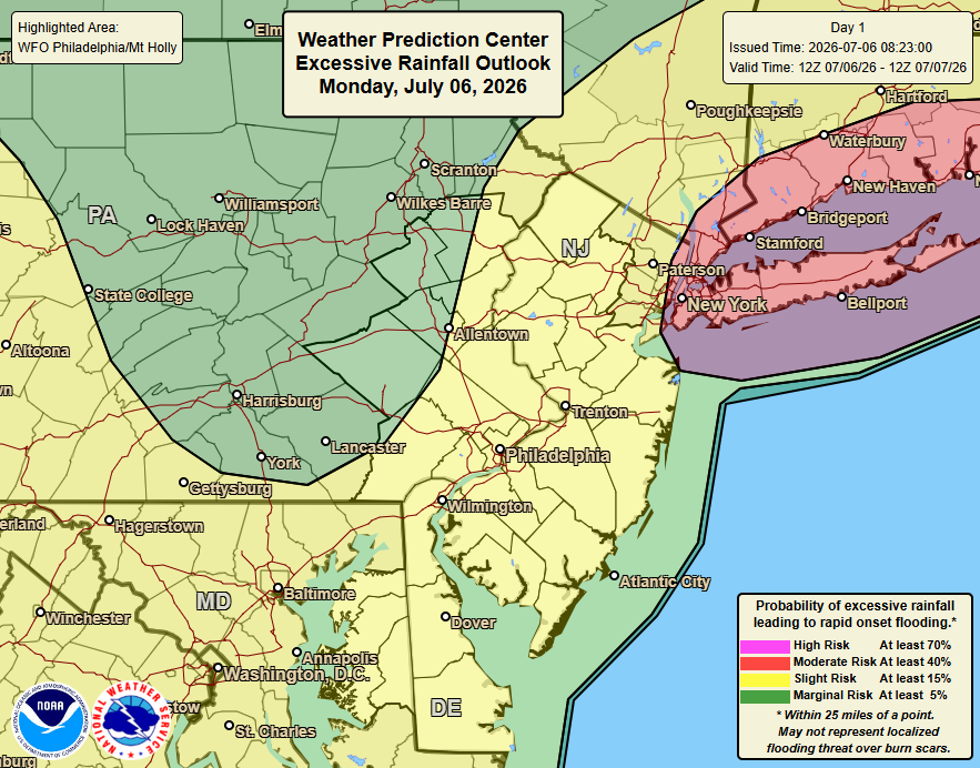
A flash flood warning has been issued in the greater Philadelphia area as heavy rain continues across parts of the region.
The warning is in place until 6:45 p.m. in southeastern Pennsylvania Monday.
Between 1 and 2 inches of rain have already fallen, and thunderstorms across the region are continuing.
Find out what's happening in Across Pennsylvaniafor free with the latest updates from Patch.
Flash flooding has already been reported in multiple urban areas, including Kelly Drive near Lemon Hill, and Frankford Creek near Frankford.
"Flooding of small creeks and streams, urban areas,
highways, streets, and underpasses as well as other
drainage and low lying areas" is possible, the National Weather Service's Mt. Holly, New Jersey branch shared.
Find out what's happening in Across Pennsylvaniafor free with the latest updates from Patch.
Drivers are urged to turn around if they see standing water, and not to attempt to drive through it.
The following roadways are threatened, the agency said:
- Interstate 476 in Pennsylvania between mile markers 0 and 9
- Interstate 76 in Pennsylvania between mile markers 335 and 351
- Interstate 95 in Pennsylvania between mile markers 4 and 38
- Interstate 676 in Pennsylvania between mile markers 0 and 1
- Interstate 676 in New Jersey between mile markers 0 and 4
- Interstate 76 in New Jersey between mile markers 0 and 3
- Interstate 295 in New Jersey between mile markers 13 and 28
Here's the full forecast:
Monday Night
Showers likely and possibly a thunderstorm before 7 p.m., then a chance of showers and thunderstorms after 7 p.m. Cloudy, with a low around 67. Northeast wind around 10 mph. Chance of precipitation is 60 percent. New rainfall amounts between a tenth and quarter of an inch, except higher amounts possible in thunderstorms.
Tuesday
A chance of showers before 10 a.m., then a slight chance of showers and thunderstorms after 2 p.m. Mostly cloudy, with a high near 79. Northeast wind around 5 mph. Chance of precipitation is 30 percent. New rainfall amounts of less than a tenth of an inch, except higher amounts possible in thunderstorms.
Tuesday Night
A slight chance of showers and thunderstorms before 8 p.m., then a slight chance of showers between 8 p.m. and 2 a.m. Mostly cloudy, with a low around 66. Northeast wind 5 to 10 mph. Chance of precipitation is 20 percent.
Wednesday
Mostly sunny, with a high near 83. Northeast wind around 5 mph.
Wednesday Night
Partly cloudy, with a low around 67.
Thursday
A chance of showers after 2 p.m. Partly sunny, with a high near 87. Chance of precipitation is 30 percent.
Thursday Night
A chance of showers before 8 p.m., then a chance of showers and thunderstorms between 8 p.m. and 2 a.m. Mostly cloudy, with a low around 72. Chance of precipitation is 40 percent.
Friday
A chance of showers and thunderstorms after 2 p.m. Partly sunny, with a high near 88. Chance of precipitation is 50 percent.
Friday Night
A chance of showers and thunderstorms before 8 p.m. Partly cloudy, with a low around 72. Chance of precipitation is 30 percent.
Saturday
A chance of showers and thunderstorms. Partly sunny, with a high near 89. Chance of precipitation is 50 percent.
Saturday Night
A chance of thunderstorms. Partly cloudy, with a low around 68. Chance of precipitation is 30 percent.
Sunday
Mostly sunny, with a high near 86.
Get more local news delivered straight to your inbox. Sign up for free Patch newsletters and alerts.