Weather
Risk Of Damaging Winds, Large Hail Increases In NJ Ahead Of Severe Storms
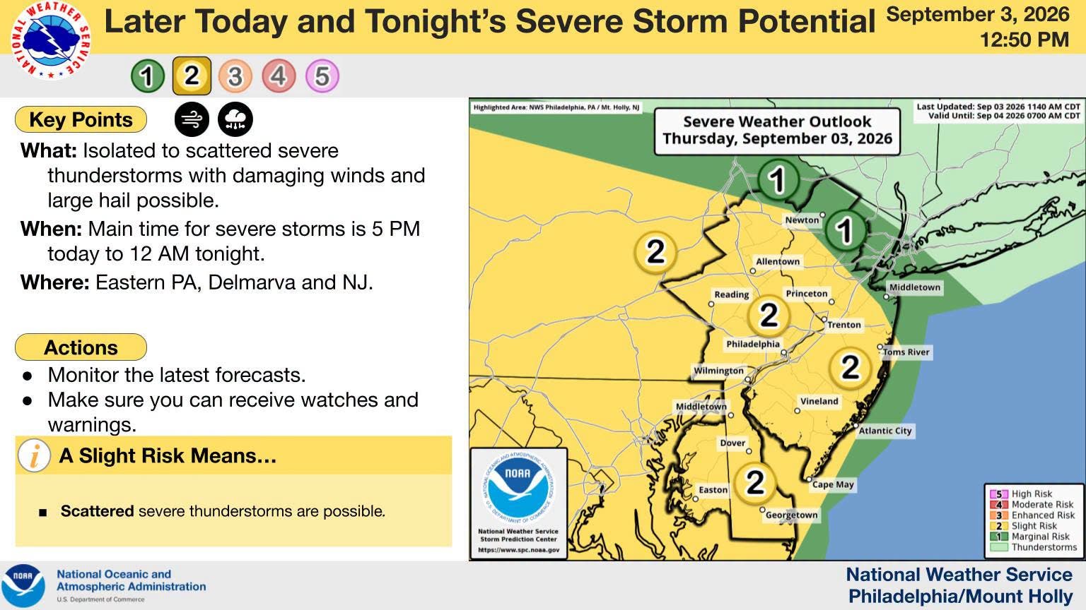
The National Weather Service increased its risk for severe thunderstorms in Pennsylvania for Thursday night.


An increased risk of severe thunderstorms with heavy downpours has expanded to most of New Jersey on Thursday.
"The main severe potential is focused primarily on tonight. The intensity, extent and timing depend on thunderstorm development well to our west and northwest this afternoon," according to the National Weather Service(NWS).
Isolated to scattered severe thunderstorms with damaging winds and large hail are possible late from 5 p.m. Thursday through 12 a.m. Friday.
Find out what's happening in Across Pennsylvaniafor free with the latest updates from Patch.
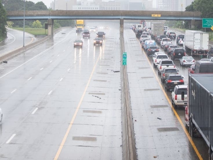
Heavy rain could lead to flash flooding in some areas. This is in addition to the rain that already fell on Thursday morning.
Additionally, parts of South Jersey and Pennsylvania are under a Heat Advisory on Thursday.
Find out what's happening in Across Pennsylvaniafor free with the latest updates from Patch.
The advisory remains in effect from 11 a.m. to 8 p.m. for portions of southeast Pennsylvania and New Jersey, along with the eastern shores of Maryland and Delaware.
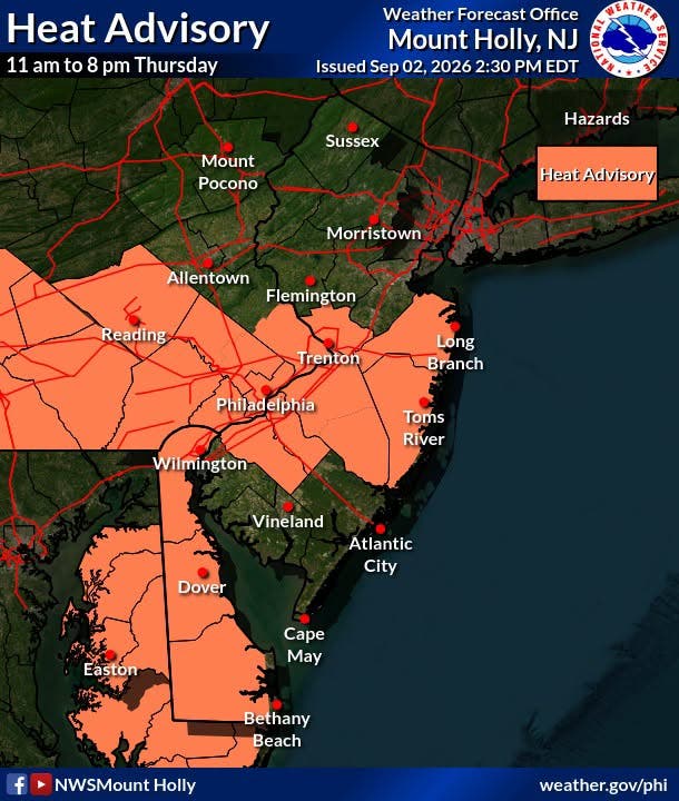
The NWS said heat index values are expected to peak in the mid-90s to mid-100s.
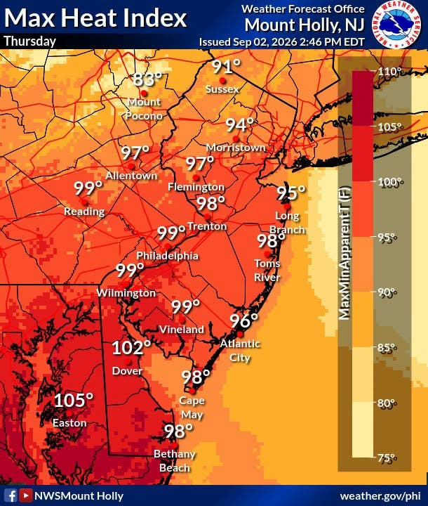
The highest heat concern includes the Philadelphia urban corridor and some adjacent areas of southeast Pennsylvania and New Jersey, as well as the eastern shores of Maryland and Delaware.
Here is a look at the weather ahead, including a sneak peek of the forecast for Labor Day weekend:
Thursday: A slight chance of showers and thunderstorms before 4 p.m., then a chance of showers and thunderstorms after 5 p.m. Some of the storms could produce heavy rainfall. Partly sunny, with a high near 91. Heat index values as high as 102. West wind around 5 mph. Chance of precipitation is 30 percent. New rainfall amounts of less than a tenth of an inch, except higher amounts possible in thunderstorms.
Thursday Night: A chance of showers and thunderstorms, mainly between 1 and 2 a.m. Mostly cloudy, with a low around 73. Southwest wind around 5 mph becoming calm. Chance of precipitation is 40 percent. New rainfall amounts between a tenth and quarter of an inch, except higher amounts possible in thunderstorms.
Friday: A chance of showers and thunderstorms between 2 and 3 p.m., then showers likely and possibly a thunderstorm after 3 p.m. Mostly sunny, with a high near 88. Calm wind becoming west around 5 mph in the morning. Chance of precipitation is 60 percent. New rainfall amounts between a quarter and half of an inch possible.
Friday Night: A chance of showers and thunderstorms before 8 p.m., then a chance of showers between 8 p.m. and 2 a.m. Mostly cloudy, with a low around 68. Northwest wind around 5 mph. Chance of precipitation is 30 percent. New precipitation amounts between a tenth and quarter of an inch, except higher amounts possible in thunderstorms.
Saturday: Sunny, with a high near 82. North wind 5 to 10 mph.
Saturday Night: Mostly clear, with a low around 62.
Sunday: Sunny, with a high near 79.
Sunday Night: Mostly clear, with a low around 59.
Labor Day: Sunny, with a high near 81.
Get more local news delivered straight to your inbox. Sign up for free Patch newsletters and alerts.