Weather
'Long-Duration Storm' Barrels Towards Mid-Atlantic: See Latest PA Nor'easter Forecast
Forecasters cite a "long duration storm" for some, though the track of the storm remains up in the air.


As the looming nor'easter continues to develop along the Atlantic coast, the exact impacts on the greater Philadelphia area remain uncertain.
While the storm's most severe impacts will be along the coast, how it tracks over the next day or so will determine how far inland the most significant impacts reach. Gale conditions, destructive winds, and urban flooding from heavy rain are all possible.
"This will be a long-duration storm for many areas along the mid-Atlantic and New England coasts, with impacts beginning along the central Atlantic coast at midweek, spreading to New England on Friday and lasting through the weekend in some areas," Accuweather said.
Find out what's happening in Across Pennsylvaniafor free with the latest updates from Patch.
Rain, possibly heavy at times, could hit from Friday through Sunday.
On Wednesday afternoon, the National Weather Service issued a more skeptical take, and said they expect to have a better grasp of impacts and hazards for this weekend over the next 24 to 36 hours.
Find out what's happening in Across Pennsylvaniafor free with the latest updates from Patch.
"Confidence is low in how long impacts will continue as there is significant uncertainty with the track of the coastal low," the National Weather Service's Mt. Holly, New Jersey branch shared.
In the meantime, conditions this week could lead to additional tidal flooding on parts of the Delaware River. A coastal flood watch has been issued in Philadelphia, lower Bucks, and Delaware counties from 10 p.m. Wednesday through 4 a.m. Friday.
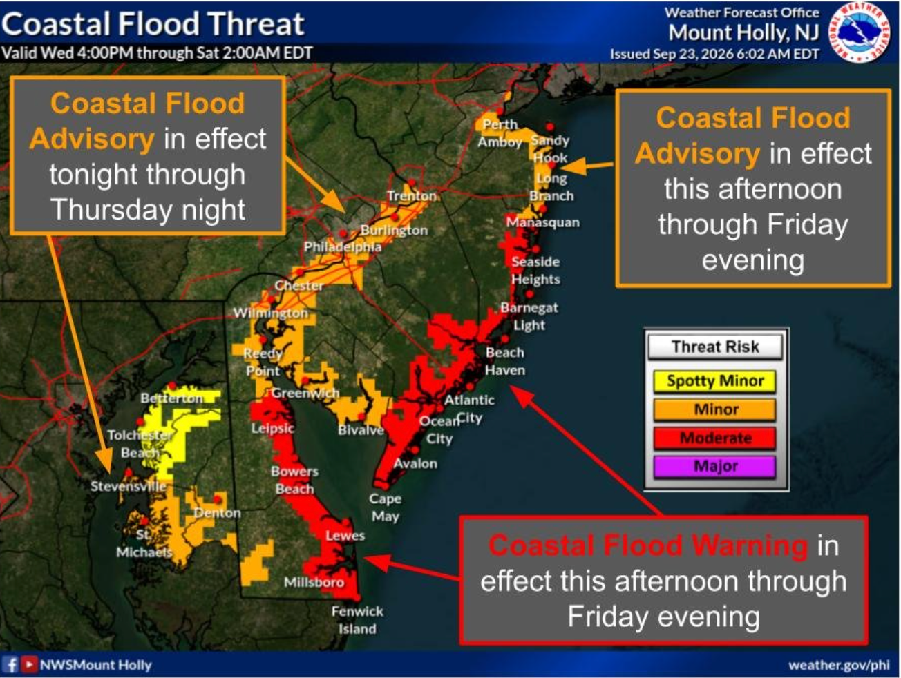
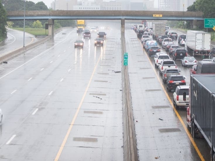
The most vulnerable roadways within the advisory area are likely to flood, forecasters said.
Here's the full forecast for the coming week:
Wednesday
Mostly cloudy, with a high near 68. Breezy, with a northeast wind 15 to 20 mph, with gusts as high as 30 mph.
Wednesday Night
Partly cloudy, with a low around 53. Northeast wind around 15 mph.
Thursday
Partly sunny, with a high near 67. Northeast wind around 15 mph, with gusts as high as 25 mph.
Thursday Night
Mostly cloudy, with a low around 53. North wind 10 to 15 mph.
Friday
A chance of showers, mainly after 2 p.m. Partly sunny, with a high near 69. North wind around 15 mph, with gusts as high as 30 mph. Chance of precipitation is 30 percent. New precipitation amounts of less than a tenth of an inch possible.
Friday Night
A chance of showers, mainly before 8 p.m. Mostly cloudy, with a low around 57. Chance of precipitation is 30 percent. New precipitation amounts of less than a tenth of an inch possible.
Saturday
A chance of showers. Partly sunny, with a high near 69. Chance of precipitation is 40 percent.
Saturday Night
A chance of showers. Mostly cloudy, with a low around 57. Chance of precipitation is 40 percent.
Sunday
A chance of showers before 2 p.m. Partly sunny, with a high near 69. Chance of precipitation is 30 percent.
Sunday Night
Mostly cloudy, with a low around 57.
Monday
Mostly sunny, with a high near 73.
Monday Night
Partly cloudy, with a low around 57.
Tuesday
Mostly sunny, with a high near 76.
Get more local news delivered straight to your inbox. Sign up for free Patch newsletters and alerts.