Weather
Snow, Wind: How Incoming Nor’Easter Will Impact PA
This storm has potential to be what forecasters call a "bomb cyclone"and pack a punch with damaging winds, snowfall amounts and flooding.


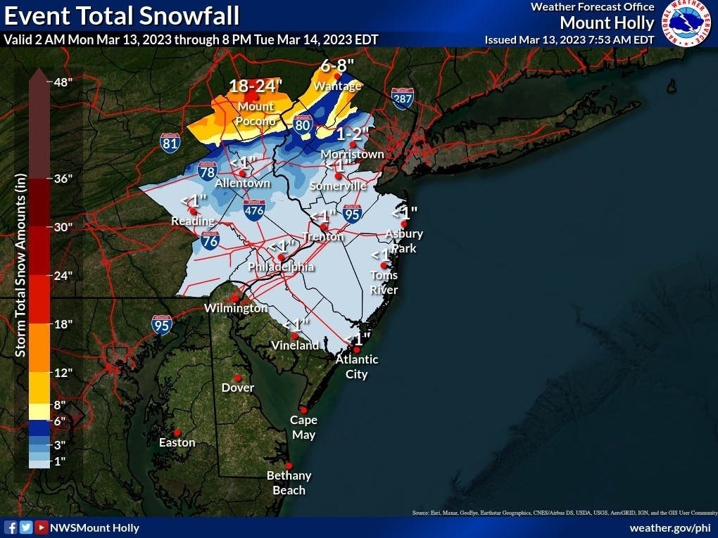
PENNSYLVANIA — Forecasters call for high winds and up to to 18 inches of snow in parts of Pennsylvania as a nor’easter moves through the region early this week.
This storm has the potential to turn into what forecasters call a “bomb cyclone”and pack a punch with damaging winds, snowfall amounts and coastal flooding, according to AccuWeather. Snow could fall at a rate of one to two inches an hour, added the National Weather Service.
Communities as far south as Philadelphia could see a dusting of snow, while those along the I-80 corridor may see between 12 and 18 inches tonight and Tuesday.
Find out what's happening in Across Pennsylvaniafor free with the latest updates from Patch.
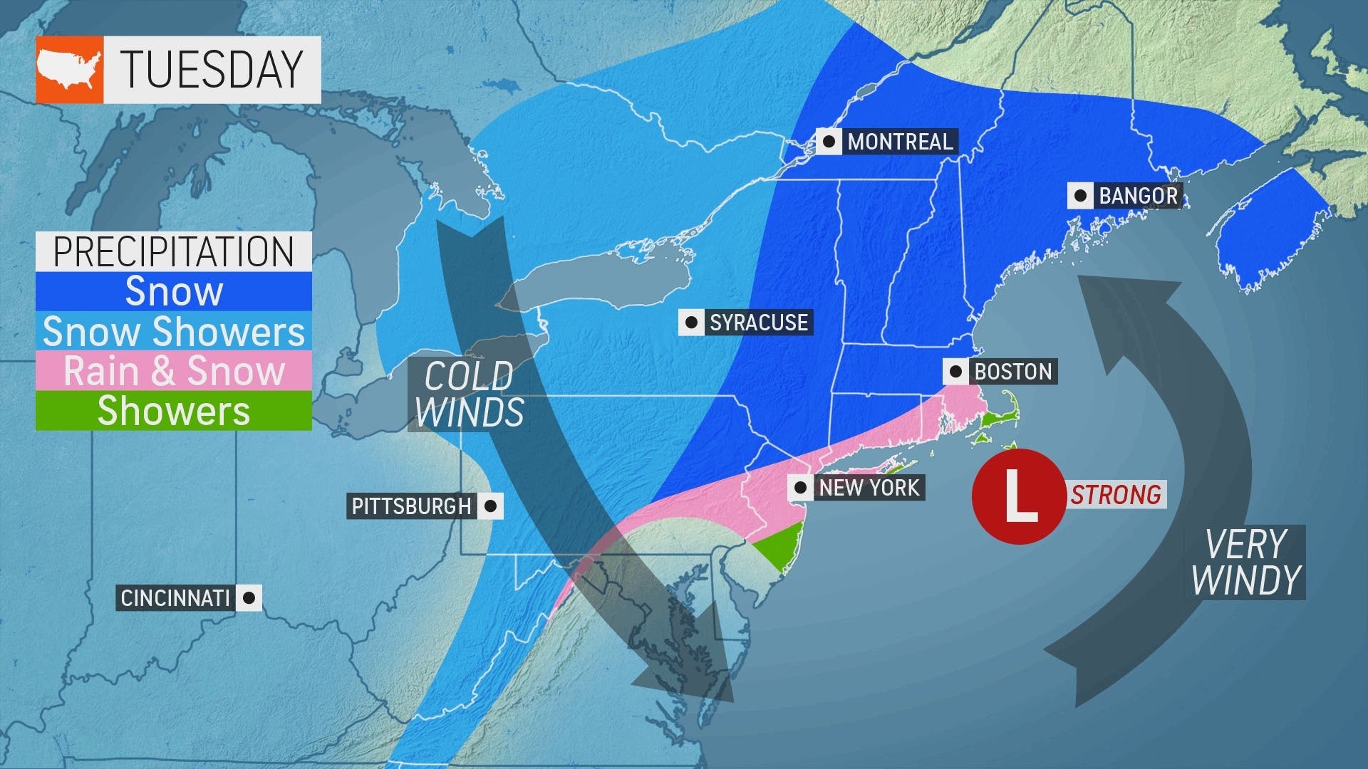
There’s also an enhanced wind risk that could cause power outages throughout the state, with some tree damage possible.
“The snow will be heavy and wet in nature, which can lead to snapped branches and downed power lines,” explained AccuWeather Meteorologist Renee Duff.
Find out what's happening in Across Pennsylvaniafor free with the latest updates from Patch.
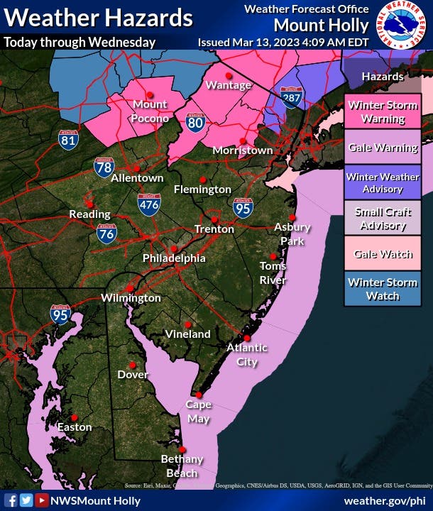
A winter storm warning is already in effect for Wayne, Carbon, and Monroe Counties, where more than a foot of wet snow is possible.
The wind is also a risk for the entire area, said forecasters.
AccuWeather says to expect blustery winds ranging from 40-50 mph across central and eastern Pennsylvania.
Gale force winds with gusts of 35-45 knots on the NJ/DE Atlantic Coast and the Delaware Bay are expected Tuesday into Wednesday, added the NWS.
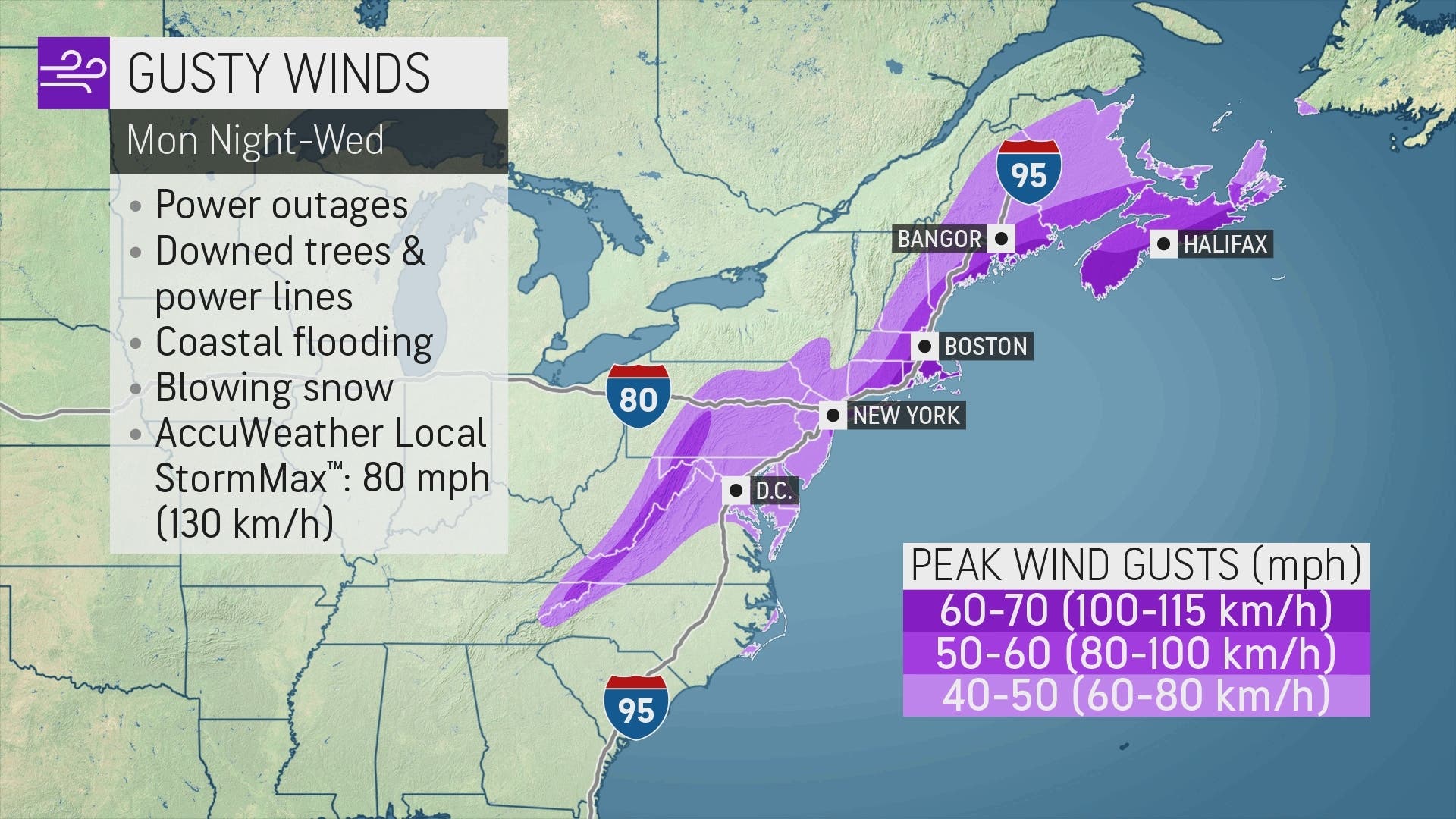
Coastal flooding will also be a concern, AccuWeather forecasters say.
Here is a look at the forecast around eastern Pennsylvania early this week:
Philadelphia
Monday
Rain. High near 45. Northeast wind around 5 mph. Chance of precipitation is 90%. New precipitation amounts between a quarter and half of an inch possible.
Monday Night
Rain. Low around 35. Northwest wind 10 to 15 mph. Chance of precipitation is 90%. New precipitation amounts between a half and three quarters of an inch possible.
Tuesday
Snow likely before 11am, then rain and snow likely between 11am and 2pm, then a chance of rain after 2pm. Cloudy, with a high near 39. Breezy, with a west wind 20 to 25 mph, with gusts as high as 40 mph. Chance of precipitation is 70%. New snow accumulation of less than a half inch possible.
Tuesday Night
A chance of rain before 8pm. Mostly cloudy, with a low around 32. Breezy, with a northwest wind around 25 mph, with gusts as high as 40 mph. Chance of precipitation is 30%. New precipitation amounts of less than a tenth of an inch possible.
Get more local news delivered straight to your inbox. Sign up for free Patch newsletters and alerts.