Weather
Storms, Heavy Rain In Philly Area July 4 Forecast
The forecast calls for a high near 97, a heat index up to 103 and a chance of heavy rainfall later in the day.

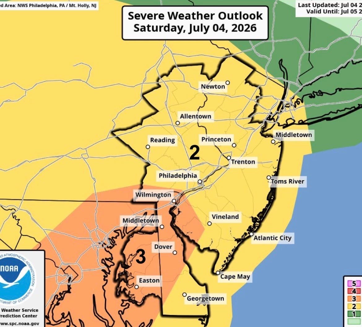
Storms and heavy rain threaten to put a damper on July 4 celebrations throughout the Philadelphia region Saturday. Hot weather is expected to build through the day, with thunderstorms possible later this afternoon and more likely tonight, according to the forecast.
The daytime outlook calls for mostly sunny skies and a high near 97. Heat index values could climb as high as 103. A west wind of around 10 mph is expected, with gusts reaching as high as 20 mph.
There is a chance of showers and thunderstorms, starting mainly after 5 p.m., according to The National Weather Service. Some of the storms could produce heavy rainfall. Damaging winds are also possible. New rainfall amounts are expected to be less than a tenth of an inch in most places, though higher amounts are possible in thunderstorms.
Find out what's happening in Across Pennsylvaniafor free with the latest updates from Patch.
Conditions are expected to stay unsettled into the evening. Showers and thunderstorms are likely tonight, mainly before 1 a.m., followed by a slight chance of thunderstorms after 5 a.m. Some of those storms could also produce heavy rainfall, according to the forecast.
The chance of precipitation increases to 70 percent tonight. Forecast rainfall totals range between a tenth and a quarter of an inch, except where thunderstorms produce higher amounts.
Find out what's happening in Across Pennsylvaniafor free with the latest updates from Patch.
The combination of intense heat during the day and the potential for heavy rain later means residents may want to keep an eye on changing conditions, especially in the late afternoon and evening when storm chances increase.
The forecast timeline points to the greatest heat during the day, followed by the highest storm chances tonight. After 5 p.m., showers and thunderstorms become possible, and the likelihood of wet weather continues into the overnight hours before easing later toward morning.
Get more local news delivered straight to your inbox. Sign up for free Patch newsletters and alerts.