Weather
Tornado Watch Issued Ahead Of Severe Storms In PA: Latest Forecast
A tornado watch covers portions of eastern PA as severe storms threaten damaging winds, flash flooding, large hail and tornadoes.


A tornado watch is in effect for parts of eastern Pennsylvania on Saturday as severe storms are expected to bring heavy rain, damaging winds and large hail to the state.
The National Weather Service said the tornado watch is in effect until 9 p.m. Saturday for the following counties: Berks, Bucks, Carbon, Chester, Delaware, Lehigh, Monroe, Montgomery, Northampton and Philadelphia counties.
According to forecasters, several rounds of showers and thunderstorms were possible Saturday morning and will likely continue through the evening hours.
Find out what's happening in Across Pennsylvaniafor free with the latest updates from Patch.
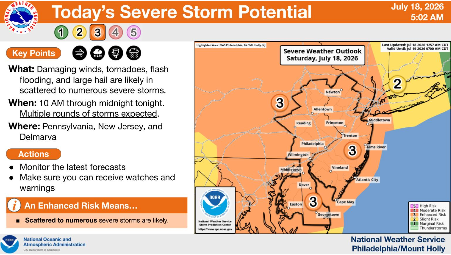
The NWS Storm Prediction Center placed that state at an Enhanced Risk (3 of 5) for severe weather, meaning severe thunderstorms will be capable of producing damaging winds, flash flooding, frequent cloud-to-ground lightning and large hail.
The risk of tornadoes is also "notably high," according to the NWS.
Find out what's happening in Across Pennsylvaniafor free with the latest updates from Patch.
"The primary threats are damaging winds as well as
tornadoes, with potential for a stronger tornado, potentially as
strong as an EF2," the NWS wrote.
In addition to the severe potential, any thunderstorms on Saturday will be capable of producing very heavy rainfall with rates of 2 to 3 inches per hour possible. This could lead to flash flooding of urban and poorly drained areas, creeks, and streams.
A flash flood watch is also in effect until 2 a.m. Sunday for eastern Pennsylvania, New Jersey and Northern Delaware.
Here's the latest forecast for the weekend and the start of the work week:
Saturday: A chance of showers and thunderstorms, then showers likely and possibly a thunderstorm after 4pm. Some of the storms could be severe. Areas of smoke. Mostly cloudy, with a high near 88. Southwest wind around 10 mph, with gusts as high as 20 mph. Chance of precipitation is 60%. New rainfall amounts between a quarter and half of an inch possible.
Saturday Night: Showers and possibly a thunderstorm before 8pm, then a chance of showers and thunderstorms between 8pm and 2am, then a slight chance of showers after 2am. Some of the storms could be severe. Patchy smoke before 7pm. Low around 73. Southwest wind 5 to 10 mph. Chance of precipitation is 80%. New rainfall amounts between a half and three quarters of an inch possible.
Sunday: Partly sunny, then gradually becoming sunny, with a high near 86. Northwest wind 5 to 10 mph.
Sunday Night: Mostly clear, with a low around 68. North wind around 5 mph.
Monday: Sunny, with a high near 86. Northeast wind around 5 mph becoming calm.
Monday Night: A chance of showers and thunderstorms after 2am. Mostly cloudy, with a low around 72. Chance of precipitation is 30%. New rainfall amounts of less than a tenth of an inch, except higher amounts possible in thunderstorms.
Tuesday: A chance of showers, then showers likely and possibly a thunderstorm after 2pm. Cloudy, with a high near 84. Chance of precipitation is 70%.
Get more local news delivered straight to your inbox. Sign up for free Patch newsletters and alerts.