Weather
Updated Nor'easter Forecast As Storms Approach Philly Area
The latest on the powerful front moving up the Atlantic:


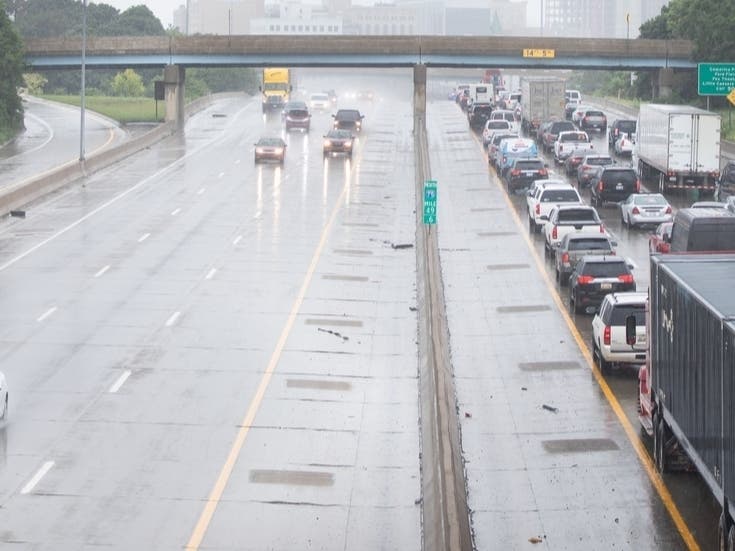
The storms washing over the region from the Midwest will stall over the coming days, leading to lingering rain in the Philadelphia region that could trigger flash flooding, according to forecasters.
"Multiple rounds of tidal flooding are expected this week," the National Weather Service said. Minor flooding is possible along the tidal Delaware River Tuesday afternoon, while Wednesday afternoon could see more significant flooding there.
Wednesday will also bring gusting winds up to 35 miles per hour around the local region.
Find out what's happening in Across Pennsylvaniafor free with the latest updates from Patch.
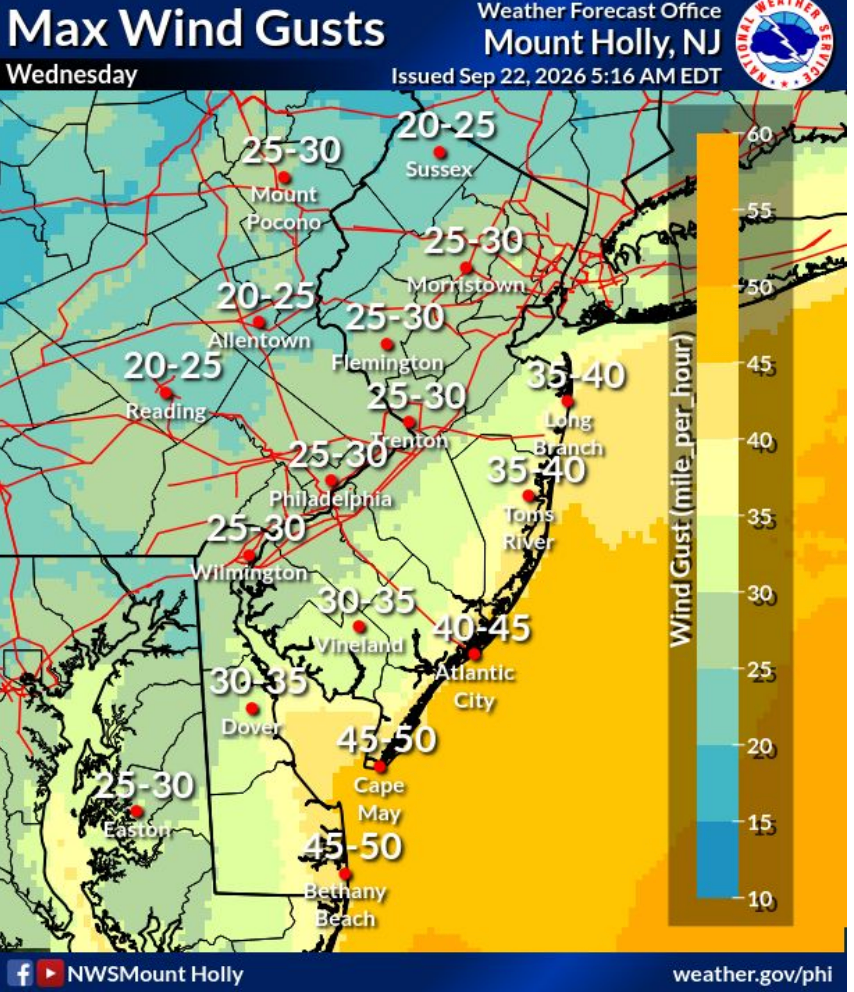
But these midweek impacts are not the primary concern of forecasters.
A much larger and more formidable storm front is developing along the Atlantic Coast that could turn into a nor'easter when it arrives on Friday.
Find out what's happening in Across Pennsylvaniafor free with the latest updates from Patch.
The exact forecast remains "uncertain," the National Weather Service said, though potentially destructive winds, power outages, heavy rain, and additional flooding throughout urban areas, not just along the tidal Delaware, are all possible.
The nor'easter's impacts could be felt from Friday and throughout the weekend, until later Sunday.
Much will depend on the exact track of the storm, which still is not yet clear. Great clarity is expected in the next few days as it draws nearer.
"The storm may wander out to sea for a time, then drift west and return close to the coast later this week," Accuweather said. "More significant impacts will occur should the storm strengthen over open water and turn back toward the mid-Atlantic or New England coast, while less severe impacts would occur if the storm continued moving along rather than turning back toward the coast."
The Philadelphia area is within the edge of Accuweather's most severely impacted region. If the storm does not gain strength by turning out to sea before hitting the coast, the impacts to the area would be less significant.
Here's the full forecast for the coming week around the region:
Tuesday
Showers, mainly before 4 p.m. High near 64. Northeast wind around 10 mph, with gusts as high as 20 mph. Chance of precipitation is 80 percent. New precipitation amounts between a tenth and quarter of an inch possible.
Tuesday Night
A chance of showers, mainly before 7 p.m. Mostly cloudy, with a low around 56. Northeast wind 10 to 15 mph. Chance of precipitation is 30 percent. New precipitation amounts of less than a tenth of an inch possible.
Wednesday
Mostly cloudy, with a high near 67. Breezy, with a northeast wind 15 to 20 mph.
Wednesday Night
Mostly cloudy, with a low around 54. Northeast wind around 15 mph.
Thursday
Partly sunny, with a high near 66. Northeast wind 10 to 15 mph.
Thursday Night
A slight chance of showers after 2 a.m. Mostly cloudy, with a low around 54. Chance of precipitation is 20 percent.
Friday
A chance of showers after 2 p.m. Partly sunny, with a high near 68. Chance of precipitation is 30 percent.
Friday Night
A chance of showers before 8 p.m., then a chance of showers after 2 a.m. Mostly cloudy, with a low around 56. Chance of precipitation is 30 percent.
Saturday
A chance of showers. Partly sunny, with a high near 68. Chance of precipitation is 40 percent.
Saturday Night
A chance of showers before 2 a.m. Mostly cloudy, with a low around 57. Chance of precipitation is 30 percent.
Sunday
Mostly sunny, with a high near 71.
Sunday Night
Partly cloudy, with a low around 57.
Monday
Mostly sunny, with a high near 72.
Get more local news delivered straight to your inbox. Sign up for free Patch newsletters and alerts.