Kids & Family
A Frosty Reality Returns
Monday night's dip back into wintery temps could be bad news for trees and gardens.
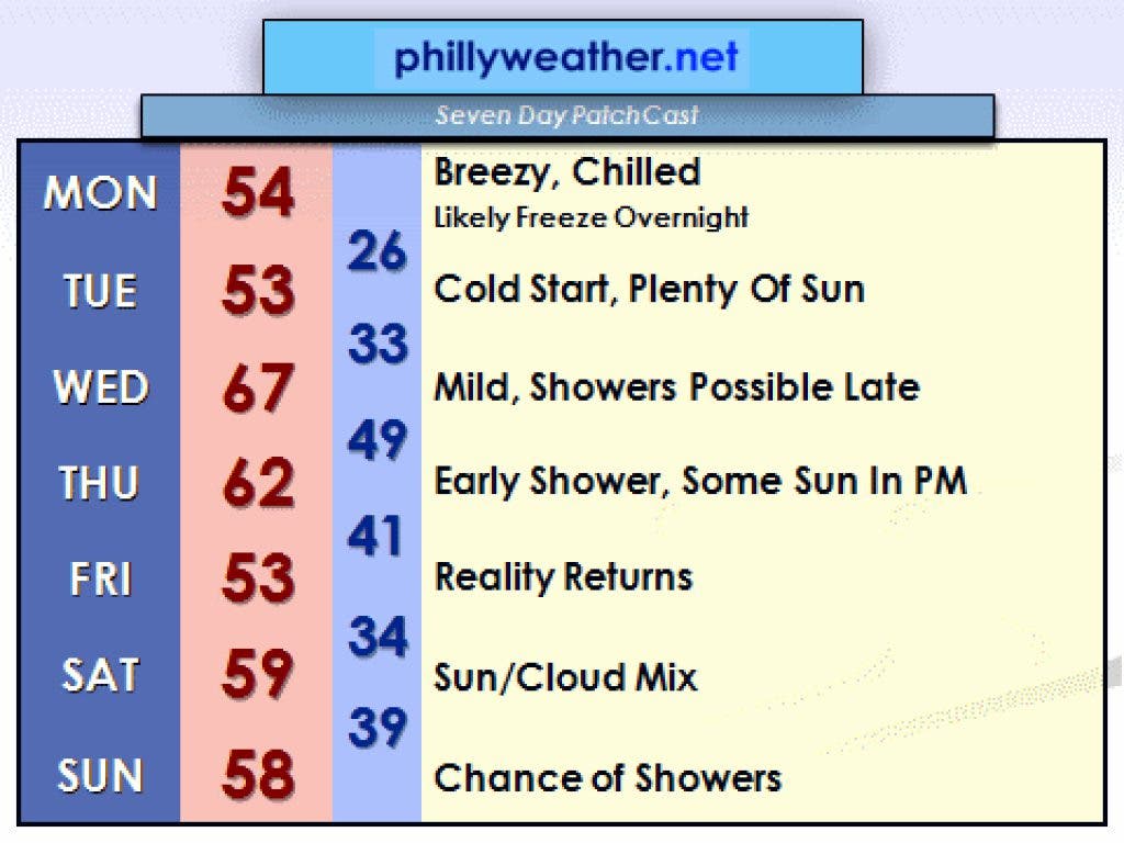
Our fling with spring has done wonders to green everything up around our region about three weeks ahead of schedule, bringing a look of late April to the region in late March. Unfortunately, the calendar will win out at this time of the year, and since it's still March, one can't fully discount the potential for at least some colder air to come back.
The funny part about this "chill" is that it's not all that cold in the scheme of things—highs in the lower and middle 50's are not far removed from the average for this time of the year (56). The problem is all of the buds on the trees, the flowers that have bloomed in your garden, and the sensitive flowering trees that bear fruit such as the cherry and apple. Monday night's frosty setup could leave them in a state of shock...and perhaps knock the fruit out of commission for the coming year. Keep your fingers crossed that we end up less cold than advertised, but modeling has been rather consistent and accurate in pushing this through.
The cold shot is short-lived as warmer air pushes back northeast for Wednesday. Temperatures will make a run into the middle and upper 60s across southeast Pennsylvania with mild southwest breezes. Showers cross the region Wednesday night and early Thursday as low pressure crosses the Great Lakes and Northeast. That low drags another cold front through, cooling us down a bit for the remainder of the week. We could have another frosty night on Friday. Another system crosses through on Sunday with a chance of showers, but as of now, neither the Wednesday nor Sunday system looks like it will offer much in the way of rain.
Find out what's happening in Lower Gwynedd-Ambler-Whitpainfor free with the latest updates from Patch.
The trend going into April is for more typical weather for this time of the year, although some warning is possible later next week. However, the trend doesn't support almost two full weeks of May weather around here. We should be a bit more in line with reality.