Community Corner
Cold Front Marks Slow End of Warm Regime
The warm-weather pattern we've enjoyed is coming to an end.

By Steven DiMartino
Afternoons with highs reaching the 70s will be long gone after Thursday as an area of low pressure drives through the Philadelphia region Thursday with periods of showers. A much colder air mass will take hold for this weekend; however, even colder conditions are on the way by the middle of next week.
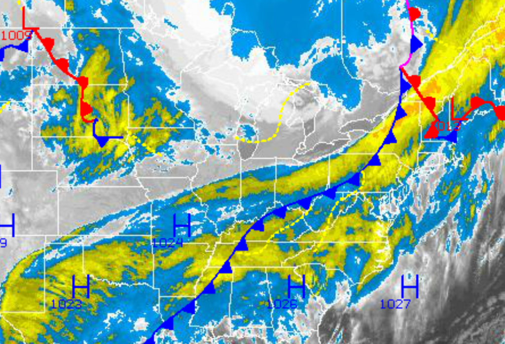
A cold front will slowly stall over the Philadelphia region Wednesday. Clouds will increase throughout the region, with an isolated shower possible but not likely. Winds will back from the southeast to south at 5 to 15 mph. Temperatures will rise into the lower to mid 60s for highs Wednesday afternoon throughout the northern Mid-Atlantic.
Find out what's happening in Lower Providencefor free with the latest updates from Patch.
An area of low pressure will move from the Northern Plains Wednesday morning through the Philadelphia area by Thursday evening and then rapidly intensifying over the New England coastal waters by Friday morning. Periods of showers will develop throughout the region tomorrow morning on through Friday afternoon as a result leading to rainfall amounts of 0.25″ to 0.75″, with locally higher amounts possible in heavy downpours. Winds will back from the south to northwest through the period at 10 to 20 mph. Temperatures Thursday morning will fall into the mid to upper 40s. Temperatures will rise into the lower to mid 50s. Temperatures on Friday will be much colder. Low temperatures will range from the mid to upper 30s. High temperatures on Friday will range from the upper 40s to lower 50s throughout the region.
High pressure will be in control for Friday evening on through Saturday, with clear skies to scattered cloud cover. A strong Polar air mass will be in place leading to temperatures averaging well below normal for this time of year. Low temperatures on Saturday morning will range from the mid to upper 20s. High temperatures on Saturday afternoon will range from the mid to upper 40s throughout the region.
Find out what's happening in Lower Providencefor free with the latest updates from Patch.
An area of low pressure will approach on Sunday, with periods of showers expected. Most of the showers will feature light to moderate rainfall. Temperatures will range from the mid to upper 30s for lows and lower to mid 50s for highs.
High pressure will be in place for Monday and Tuesday, with clear skies to scattered cloud cover. Temperatures will moderate to above normal levels by Tuesday ahead of a powerful Arctic cold front that is expected to force temperatures to well below normal levels by the end of next week. Temperatures on Monday will range from the lower to mid 30s for lows and mid to upper 50s for highs. Temperatures on Tuesday will range from the upper 30s to lower 40s for lows and upper 50s to lower 60s for highs.
Get more local news delivered straight to your inbox. Sign up for free Patch newsletters and alerts.