Community Corner
Mild Weather Conditions Won't Last Long
Warm conditions will be in place through Wednesday, but cold and stormy weather is on the way.

By Steven DiMartino
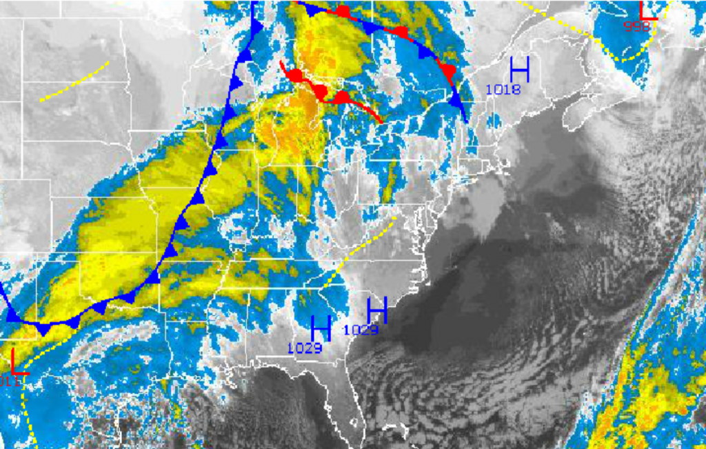
High pressure shifting off the East coast Tuesday morning will provide mild and tranquil weather conditions for the Philadelphia region through Wednesday. However, the mild conditions won’t last long, as an area of low pressure will bring heavy rain to the region on Thursday evening and much colder temperatures by this weekend.
Through Wednesday, high pressure will produce clear skies to scattered cloud cover. Winds will back from the west to the southwest at 5 to 15 mph. Temperatures Tuesday afternoon will rise into the mid to upper 60s. Temperatures Tuesday night will fall into the lower to mid 40s. Temperatures Wednesday afternoon will rise into the lower to mid 60s as clouds increase through the day.
Find out what's happening in Lower Providencefor free with the latest updates from Patch.
An area of low pressure will develop in the Ohio River Valley and race toward New England Wednesday night through Friday morning. Moderate to heavy rain will invade the Philadelphia region Thursday morning on through early Friday morning, with moderate to heavy rainfall expected. Rainfall amounts will range from 1 to 2 inches throughout the northern Mid-Atlantic, with locally higher amounts expected. Localized flash flooding will be a threat from these heavy downpours. Low temperatures on Thursday will range from the upper 30s to lower 40s. High temperatures will range from the lower to mid 50s.
Showers will linger into Friday morning followed by clearing skies by Friday afternoon and evening. High pressure will produce scattered cloud cover Friday night on through Sunday morning. Temperatures will fall back to near to below-normal levels through the period. Temperatures on Friday will range from the mid to upper 40s for lows and lower to mid 50s for highs. Temperatures on Saturday will range from the upper 20s to lower 30s for lows and upper 40s to lower 50s for highs. Temperatures on Sunday will range from the mid to upper 30s for lows and lower to mid 50s for highs.
Find out what's happening in Lower Providencefor free with the latest updates from Patch.
An area of low pressure will develop off the Mid-Atlantic coast on Sunday afternoon and lift northward toward New England on Monday, leading to periods of rain for the region Sunday evening on through Monday afternoon. Temperatures will be too warm for any frozen precipitation for most locations, but a few snow flakes may mix in over the highest elevations. Low temperatures will range from the lower to mid 30s. High temperatures will range from the upper 40s to lower 50s.
Get more local news delivered straight to your inbox. Sign up for free Patch newsletters and alerts.