Community Corner
Cold Front Will End Malvern's Stretch of Mild Weather
A stormier and colder weather pattern is returning to the region.

By Steven DiMartino
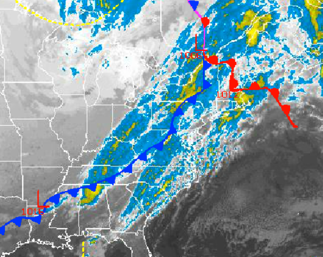
A cold front is driving through the Philadelphia region Wednesday, with periods of showers expected. The showers will mark the end of the warm regime of weather the past few days and begin the transition to a colder and stormier period of weather for this weekend.
The cold front will drive through the northern Mid-Atlantic Wednesday with periods of showers. The showers will be capable of brief heavy downpours and wind gusts over 30 mph. Winds will veer from the southwest to northwest at 10 to 20 mph. Temperatures will rise into the mid to upper 60s throughout the Philadelphia region before falling into the 50s by late afternoon.
Find out what's happening in Malvernfor free with the latest updates from Patch.
Skies will clear Wednesday night as the cold front exits and high pressure builds into the region. Scattered cloud cover is expected Thursday. Winds will be from the northwest at 10 to 20 mph through Thursday morning, decreasing to 5 to 15 mph by Thursday afternoon. Low temperatures will range from the upper 30s to lower 40s. High temperatures will range from the mid to upper 50s.
Scattered cloud cover can be expected Thursday night on through Friday afternoon with near perfect weather conditions for those going out for Halloween trick-or-treating. Winds will veer to the north at 5 to 15 mph. Low temperatures will range from the upper 20s to mid to upper 30s over the western suburbs of Philadelphia. High temperatures will rise into the mid to upper 50s throughout the Philadelphia region.
Find out what's happening in Malvernfor free with the latest updates from Patch.
An area of low pressure organizing off the Mid-Atlantic coast will produce increasing clouds on Friday evening with rain developing toward Saturday morning. The development and track of this low-pressure system is very much uncertain; however, those along the coast are more likely to be impacted by this storm on Saturday than over the interior. Periods of rain are expected through the day on Saturday with snow some mixing in at times, even along the coast. However, no snowfall accumulation is currently expected in any location. Winds will veer to the northeast at 15 to 25 mph with gusts over 30 mph at times. Low temperatures will range from the upper 30s to lower 40s. High temperatures will range from the mid to upper 50s throughout the northern Mid-Atlantic.
The storm will exit on Saturday night with clearing skies through Sunday. Rather windy conditions can be expected with winds from the northwest at 15 to 25 mph with higher gusts. Low temperatures will range from the upper 20s to lower 30s. High temperatures will range from the mid to upper 40s. The strong winds will produce wind chills in the 30s and 40s throughout the region.
High pressure will be in control on Monday and Tuesday with clear skies to scattered cloud cover. Temperatures on Monday will range from the upper 20s to lower 30s for lows and lower to mid 50s for highs. Temperatures on Tuesday will range from the upper 30s to lower 40s for lows and upper 50s to lower 60s for highs.
Get more local news delivered straight to your inbox. Sign up for free Patch newsletters and alerts.